You are here: Home > Network List > TA - USArray Transportable Network (new EarthScope stations) Stations List
> Station Y56A Pelion, SC, USA > Earthquake Result Viewer
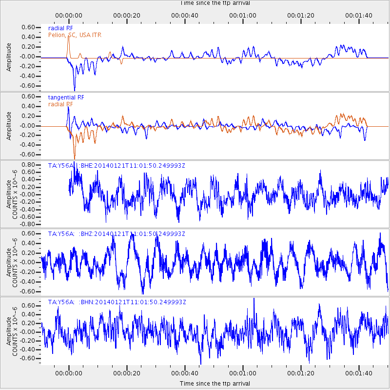
Y56A Pelion, SC, USA - Earthquake Result Viewer
*The percent match for this event was below the threshold and hence no stack was calculated.
| Earthquake location: |
Kuril Islands |
| Earthquake latitude/longitude: |
49.1/156.3 |
| Earthquake time(UTC): |
2014/01/21 (021) 10:50:00 GMT |
| Earthquake Depth: |
34 km |
| Earthquake Magnitude: |
5.5 MW |
| Earthquake Catalog/Contributor: |
ISC/ISC |
|
| Network: |
TA USArray Transportable Network (new EarthScope stations) |
| Station: |
Y56A Pelion, SC, USA |
| Lat/Lon: |
33.79 N/81.30 W |
| Elevation: |
154 m |
|
| Distance: |
82.9 deg |
| Az: |
45.102 deg |
| Baz: |
325.98 deg |
| Ray Param: |
$rayparam |
*The percent match for this event was below the threshold and hence was not used in the summary stack. |
|
| Radial Match: |
56.166306 % |
| Radial Bump: |
400 |
| Transverse Match: |
39.937424 % |
| Transverse Bump: |
400 |
| SOD ConfigId: |
3390531 |
| Insert Time: |
2019-04-10 01:50:54.230 +0000 |
| GWidth: |
2.5 |
| Max Bumps: |
400 |
| Tol: |
0.001 |
|
Signal To Noise
| Channel | StoN | STA | LTA |
| TA:Y56A: :BHZ:20140121T11:01:50.249993Z | 0.9223629 | 2.0189214E-7 | 2.188858E-7 |
| TA:Y56A: :BHN:20140121T11:01:50.249993Z | 0.7915747 | 1.8497282E-7 | 2.3367703E-7 |
| TA:Y56A: :BHE:20140121T11:01:50.249993Z | 1.0711468 | 3.1642944E-7 | 2.954118E-7 |
| Arrivals |
| Ps | |
| PpPs | |
| PsPs/PpSs | |


