You are here: Home > Network List > UW - Pacific Northwest Regional Seismic Network Stations List
> Station LCCR Mulino, OR, USA > Earthquake Result Viewer
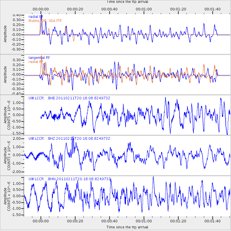
LCCR Mulino, OR, USA - Earthquake Result Viewer
*The percent match for this event was below the threshold and hence no stack was calculated.
| Earthquake location: |
Near Coast Of Central Chile |
| Earthquake latitude/longitude: |
-36.5/-73.1 |
| Earthquake time(UTC): |
2011/02/11 (042) 20:05:30 GMT |
| Earthquake Depth: |
28 km |
| Earthquake Magnitude: |
6.0 MB, 6.8 MW, 6.8 MW |
| Earthquake Catalog/Contributor: |
WHDF/NEIC |
|
| Network: |
UW Pacific Northwest Regional Seismic Network |
| Station: |
LCCR Mulino, OR, USA |
| Lat/Lon: |
45.21 N/122.48 W |
| Elevation: |
273 m |
|
| Distance: |
92.7 deg |
| Az: |
327.521 deg |
| Baz: |
142.247 deg |
| Ray Param: |
$rayparam |
*The percent match for this event was below the threshold and hence was not used in the summary stack. |
|
| Radial Match: |
55.625713 % |
| Radial Bump: |
400 |
| Transverse Match: |
53.6383 % |
| Transverse Bump: |
400 |
| SOD ConfigId: |
350818 |
| Insert Time: |
2011-07-22 10:31:13.630 +0000 |
| GWidth: |
2.5 |
| Max Bumps: |
400 |
| Tol: |
0.001 |
|
Signal To Noise
| Channel | StoN | STA | LTA |
| UW:LCCR: :BHZ:20110211T20:18:08.824973Z | 1.0228804 | 2.857949E-7 | 2.7940206E-7 |
| UW:LCCR: :BHN:20110211T20:18:08.824973Z | 1.841695 | 6.5602126E-7 | 3.5620516E-7 |
| UW:LCCR: :BHE:20110211T20:18:08.824973Z | 2.1041248 | 6.8444314E-7 | 3.2528638E-7 |
| Arrivals |
| Ps | |
| PpPs | |
| PsPs/PpSs | |


