You are here: Home > Network List > TJ - Tajikistan National Seismic Network Stations List
> Station GARM Garm, Tajikistan > Earthquake Result Viewer
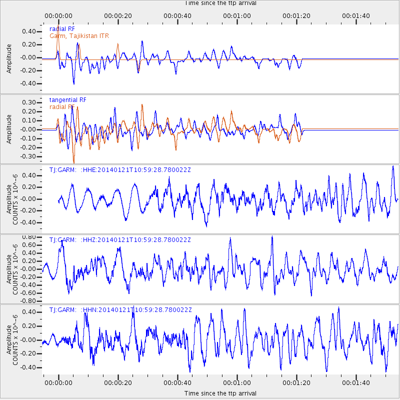
GARM Garm, Tajikistan - Earthquake Result Viewer
*The percent match for this event was below the threshold and hence no stack was calculated.
| Earthquake location: |
Kuril Islands |
| Earthquake latitude/longitude: |
49.1/156.3 |
| Earthquake time(UTC): |
2014/01/21 (021) 10:50:00 GMT |
| Earthquake Depth: |
34 km |
| Earthquake Magnitude: |
5.5 MW |
| Earthquake Catalog/Contributor: |
ISC/ISC |
|
| Network: |
TJ Tajikistan National Seismic Network |
| Station: |
GARM Garm, Tajikistan |
| Lat/Lon: |
39.00 N/70.32 E |
| Elevation: |
1305 m |
|
| Distance: |
59.5 deg |
| Az: |
295.507 deg |
| Baz: |
49.628 deg |
| Ray Param: |
$rayparam |
*The percent match for this event was below the threshold and hence was not used in the summary stack. |
|
| Radial Match: |
57.371994 % |
| Radial Bump: |
400 |
| Transverse Match: |
64.42666 % |
| Transverse Bump: |
400 |
| SOD ConfigId: |
3390531 |
| Insert Time: |
2019-04-10 01:50:58.554 +0000 |
| GWidth: |
2.5 |
| Max Bumps: |
400 |
| Tol: |
0.001 |
|
Signal To Noise
| Channel | StoN | STA | LTA |
| TJ:GARM: :HHZ:20140121T10:59:28.780022Z | 2.2128823 | 4.1079014E-7 | 1.8563577E-7 |
| TJ:GARM: :HHN:20140121T10:59:28.780022Z | 0.36511627 | 4.4308802E-8 | 1.2135533E-7 |
| TJ:GARM: :HHE:20140121T10:59:28.780022Z | 0.8995888 | 1.2143741E-7 | 1.3499212E-7 |
| Arrivals |
| Ps | |
| PpPs | |
| PsPs/PpSs | |


