You are here: Home > Network List > US - United States National Seismic Network Stations List
> Station ELK Elko, Nevada, USA > Earthquake Result Viewer
ELK Elko, Nevada, USA - Earthquake Result Viewer
*The percent match for this event was below the threshold and hence no stack was calculated.
| Earthquake location: |
Kuril Islands |
| Earthquake latitude/longitude: |
49.1/156.3 |
| Earthquake time(UTC): |
2014/01/21 (021) 10:50:00 GMT |
| Earthquake Depth: |
34 km |
| Earthquake Magnitude: |
5.5 MW |
| Earthquake Catalog/Contributor: |
ISC/ISC |
|
| Network: |
US United States National Seismic Network |
| Station: |
ELK Elko, Nevada, USA |
| Lat/Lon: |
40.74 N/115.24 W |
| Elevation: |
2210 m |
|
| Distance: |
59.8 deg |
| Az: |
61.49 deg |
| Baz: |
310.472 deg |
| Ray Param: |
$rayparam |
*The percent match for this event was below the threshold and hence was not used in the summary stack. |
|
| Radial Match: |
55.474983 % |
| Radial Bump: |
400 |
| Transverse Match: |
56.211285 % |
| Transverse Bump: |
400 |
| SOD ConfigId: |
3390531 |
| Insert Time: |
2019-04-10 01:51:19.235 +0000 |
| GWidth: |
2.5 |
| Max Bumps: |
400 |
| Tol: |
0.001 |
|
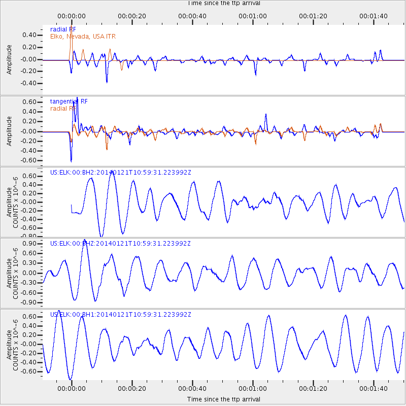
Signal To Noise
| Channel | StoN | STA | LTA |
| US:ELK:00:BHZ:20140121T10:59:31.223992Z | 2.164619 | 6.6376236E-7 | 3.0664168E-7 |
| US:ELK:00:BH1:20140121T10:59:31.223992Z | 2.055946 | 5.177376E-7 | 2.5182447E-7 |
| US:ELK:00:BH2:20140121T10:59:31.223992Z | 0.38651073 | 1.620132E-7 | 4.1916866E-7 |
| Arrivals |
| Ps | |
| PpPs | |
| PsPs/PpSs | |


