You are here: Home > Network List > TA - USArray Transportable Network (new EarthScope stations) Stations List
> Station 333A Richland Springs, TX, USA > Earthquake Result Viewer
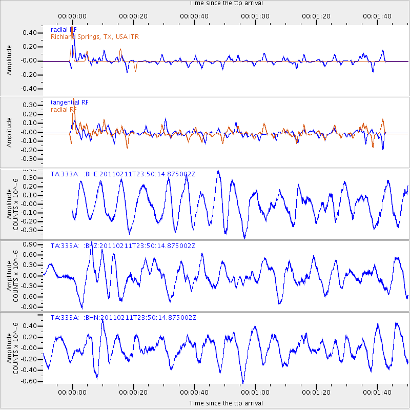
333A Richland Springs, TX, USA - Earthquake Result Viewer
*The percent match for this event was below the threshold and hence no stack was calculated.
| Earthquake location: |
Near Coast Of Central Chile |
| Earthquake latitude/longitude: |
-37.2/-73.2 |
| Earthquake time(UTC): |
2011/02/11 (042) 23:39:21 GMT |
| Earthquake Depth: |
15 km |
| Earthquake Magnitude: |
5.5 MB, 5.7 MS, 6.0 MW, 5.9 MW |
| Earthquake Catalog/Contributor: |
WHDF/NEIC |
|
| Network: |
TA USArray Transportable Network (new EarthScope stations) |
| Station: |
333A Richland Springs, TX, USA |
| Lat/Lon: |
31.32 N/98.98 W |
| Elevation: |
443 m |
|
| Distance: |
72.3 deg |
| Az: |
336.999 deg |
| Baz: |
158.616 deg |
| Ray Param: |
$rayparam |
*The percent match for this event was below the threshold and hence was not used in the summary stack. |
|
| Radial Match: |
47.466347 % |
| Radial Bump: |
400 |
| Transverse Match: |
54.492203 % |
| Transverse Bump: |
387 |
| SOD ConfigId: |
350818 |
| Insert Time: |
2011-07-22 11:30:25.325 +0000 |
| GWidth: |
2.5 |
| Max Bumps: |
400 |
| Tol: |
0.001 |
|
Signal To Noise
| Channel | StoN | STA | LTA |
| TA:333A: :BHZ:20110211T23:50:14.875002Z | 2.8101246 | 4.730884E-7 | 1.6835139E-7 |
| TA:333A: :BHN:20110211T23:50:14.875002Z | 0.5808721 | 1.1727749E-7 | 2.0189897E-7 |
| TA:333A: :BHE:20110211T23:50:14.875002Z | 1.2316073 | 2.0221741E-7 | 1.6418983E-7 |
| Arrivals |
| Ps | |
| PpPs | |
| PsPs/PpSs | |


