You are here: Home > Network List > TA - USArray Transportable Network (new EarthScope stations) Stations List
> Station 340A Bronson, TX, USA > Earthquake Result Viewer
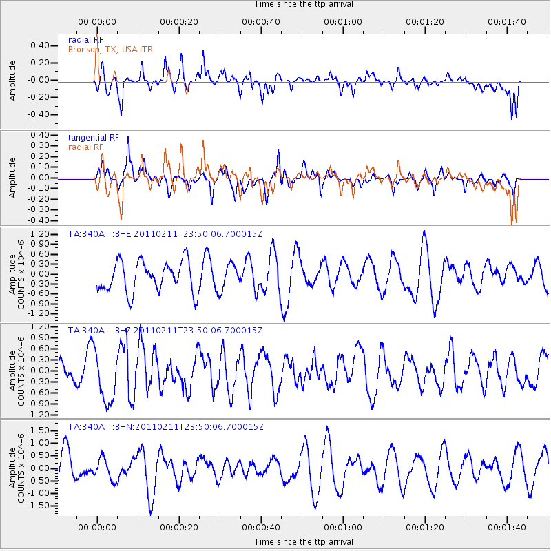
340A Bronson, TX, USA - Earthquake Result Viewer
*The percent match for this event was below the threshold and hence no stack was calculated.
| Earthquake location: |
Near Coast Of Central Chile |
| Earthquake latitude/longitude: |
-37.2/-73.2 |
| Earthquake time(UTC): |
2011/02/11 (042) 23:39:21 GMT |
| Earthquake Depth: |
15 km |
| Earthquake Magnitude: |
5.5 MB, 5.7 MS, 6.0 MW, 5.9 MW |
| Earthquake Catalog/Contributor: |
WHDF/NEIC |
|
| Network: |
TA USArray Transportable Network (new EarthScope stations) |
| Station: |
340A Bronson, TX, USA |
| Lat/Lon: |
31.42 N/93.89 W |
| Elevation: |
57 m |
|
| Distance: |
70.9 deg |
| Az: |
341.362 deg |
| Baz: |
162.633 deg |
| Ray Param: |
$rayparam |
*The percent match for this event was below the threshold and hence was not used in the summary stack. |
|
| Radial Match: |
49.795353 % |
| Radial Bump: |
400 |
| Transverse Match: |
52.663532 % |
| Transverse Bump: |
370 |
| SOD ConfigId: |
350818 |
| Insert Time: |
2011-07-22 11:34:33.633 +0000 |
| GWidth: |
2.5 |
| Max Bumps: |
400 |
| Tol: |
0.001 |
|
Signal To Noise
| Channel | StoN | STA | LTA |
| TA:340A: :BHZ:20110211T23:50:06.700015Z | 2.5313594 | 6.861191E-7 | 2.710477E-7 |
| TA:340A: :BHN:20110211T23:50:06.700015Z | 0.7025355 | 4.379688E-7 | 6.234116E-7 |
| TA:340A: :BHE:20110211T23:50:06.700015Z | 0.8518949 | 3.9195805E-7 | 4.601014E-7 |
| Arrivals |
| Ps | |
| PpPs | |
| PsPs/PpSs | |


