You are here: Home > Network List > TA - USArray Transportable Network (new EarthScope stations) Stations List
> Station U39A Green Forest, AR, USA > Earthquake Result Viewer
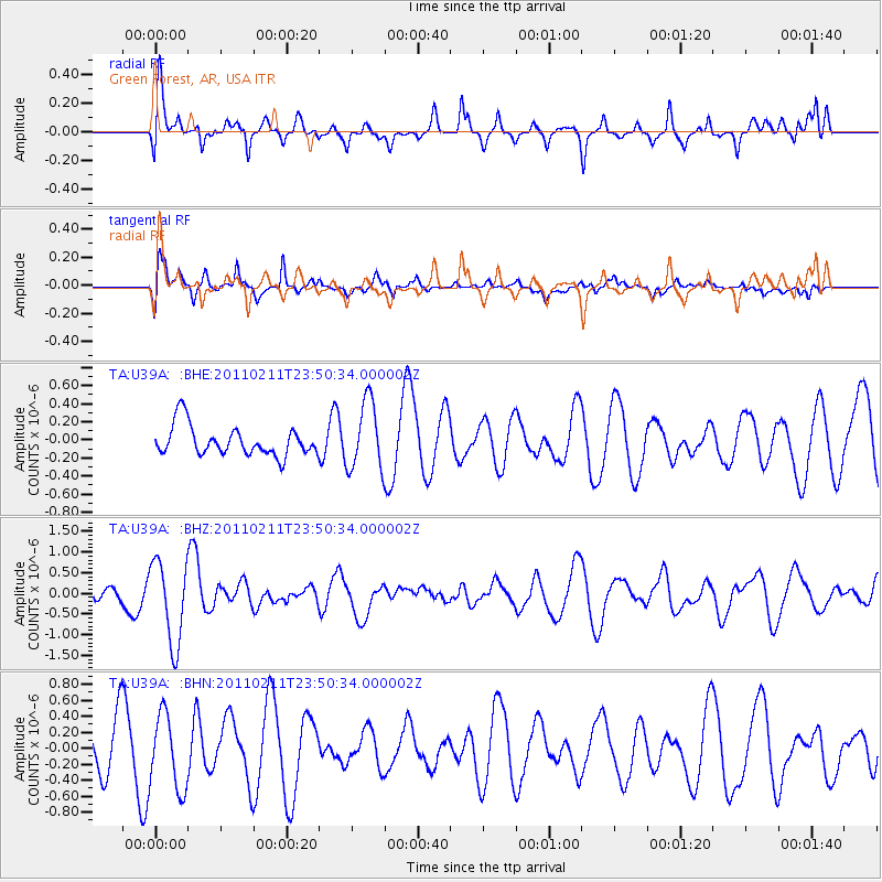
U39A Green Forest, AR, USA - Earthquake Result Viewer
*The percent match for this event was below the threshold and hence no stack was calculated.
| Earthquake location: |
Near Coast Of Central Chile |
| Earthquake latitude/longitude: |
-37.2/-73.2 |
| Earthquake time(UTC): |
2011/02/11 (042) 23:39:21 GMT |
| Earthquake Depth: |
15 km |
| Earthquake Magnitude: |
5.5 MB, 5.7 MS, 6.0 MW, 5.9 MW |
| Earthquake Catalog/Contributor: |
WHDF/NEIC |
|
| Network: |
TA USArray Transportable Network (new EarthScope stations) |
| Station: |
U39A Green Forest, AR, USA |
| Lat/Lon: |
36.38 N/93.48 W |
| Elevation: |
433 m |
|
| Distance: |
75.6 deg |
| Az: |
343.212 deg |
| Baz: |
163.393 deg |
| Ray Param: |
$rayparam |
*The percent match for this event was below the threshold and hence was not used in the summary stack. |
|
| Radial Match: |
51.918392 % |
| Radial Bump: |
400 |
| Transverse Match: |
55.039963 % |
| Transverse Bump: |
354 |
| SOD ConfigId: |
350818 |
| Insert Time: |
2011-07-22 11:54:38.597 +0000 |
| GWidth: |
2.5 |
| Max Bumps: |
400 |
| Tol: |
0.001 |
|
Signal To Noise
| Channel | StoN | STA | LTA |
| TA:U39A: :BHZ:20110211T23:50:34.000002Z | 4.7034874 | 9.970195E-7 | 2.1197454E-7 |
| TA:U39A: :BHN:20110211T23:50:34.000002Z | 1.8376002 | 4.6855558E-7 | 2.5498233E-7 |
| TA:U39A: :BHE:20110211T23:50:34.000002Z | 2.3218503 | 3.7989471E-7 | 1.6361723E-7 |
| Arrivals |
| Ps | |
| PpPs | |
| PsPs/PpSs | |


