You are here: Home > Network List > TA - USArray Transportable Network (new EarthScope stations) Stations List
> Station Z40A Long Farm, Magnolia, AR, USA > Earthquake Result Viewer
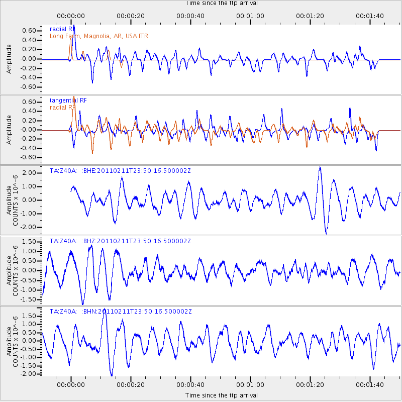
Z40A Long Farm, Magnolia, AR, USA - Earthquake Result Viewer
*The percent match for this event was below the threshold and hence no stack was calculated.
| Earthquake location: |
Near Coast Of Central Chile |
| Earthquake latitude/longitude: |
-37.2/-73.2 |
| Earthquake time(UTC): |
2011/02/11 (042) 23:39:21 GMT |
| Earthquake Depth: |
15 km |
| Earthquake Magnitude: |
5.5 MB, 5.7 MS, 6.0 MW, 5.9 MW |
| Earthquake Catalog/Contributor: |
WHDF/NEIC |
|
| Network: |
TA USArray Transportable Network (new EarthScope stations) |
| Station: |
Z40A Long Farm, Magnolia, AR, USA |
| Lat/Lon: |
33.26 N/93.40 W |
| Elevation: |
78 m |
|
| Distance: |
72.6 deg |
| Az: |
342.347 deg |
| Baz: |
163.202 deg |
| Ray Param: |
$rayparam |
*The percent match for this event was below the threshold and hence was not used in the summary stack. |
|
| Radial Match: |
59.967648 % |
| Radial Bump: |
400 |
| Transverse Match: |
62.819633 % |
| Transverse Bump: |
400 |
| SOD ConfigId: |
350818 |
| Insert Time: |
2011-07-22 11:55:23.182 +0000 |
| GWidth: |
2.5 |
| Max Bumps: |
400 |
| Tol: |
0.001 |
|
Signal To Noise
| Channel | StoN | STA | LTA |
| TA:Z40A: :BHZ:20110211T23:50:16.500002Z | 1.8375779 | 9.361396E-7 | 5.0944215E-7 |
| TA:Z40A: :BHN:20110211T23:50:16.500002Z | 1.0113031 | 6.687117E-7 | 6.612377E-7 |
| TA:Z40A: :BHE:20110211T23:50:16.500002Z | 0.8609813 | 5.704936E-7 | 6.6260867E-7 |
| Arrivals |
| Ps | |
| PpPs | |
| PsPs/PpSs | |


