You are here: Home > Network List > US - United States National Seismic Network Stations List
> Station EGMT Eagleton, Montana, USA > Earthquake Result Viewer
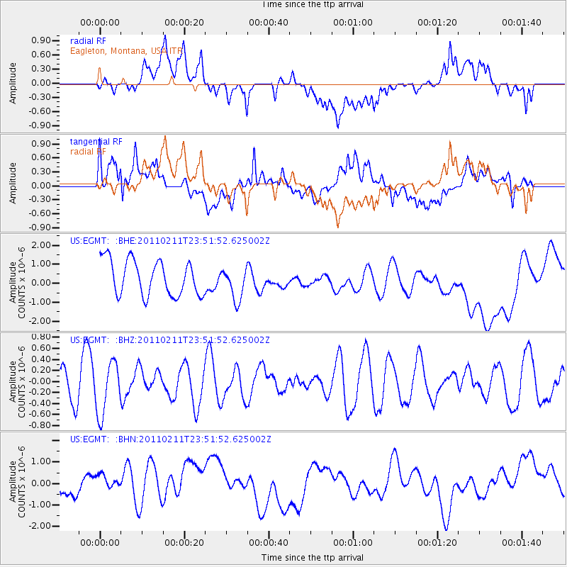
EGMT Eagleton, Montana, USA - Earthquake Result Viewer
*The percent match for this event was below the threshold and hence no stack was calculated.
| Earthquake location: |
Near Coast Of Central Chile |
| Earthquake latitude/longitude: |
-37.2/-73.2 |
| Earthquake time(UTC): |
2011/02/11 (042) 23:39:21 GMT |
| Earthquake Depth: |
15 km |
| Earthquake Magnitude: |
5.5 MB, 5.7 MS, 6.0 MW, 5.9 MW |
| Earthquake Catalog/Contributor: |
WHDF/NEIC |
|
| Network: |
US United States National Seismic Network |
| Station: |
EGMT Eagleton, Montana, USA |
| Lat/Lon: |
48.02 N/109.75 W |
| Elevation: |
1055 m |
|
| Distance: |
90.9 deg |
| Az: |
336.429 deg |
| Baz: |
151.597 deg |
| Ray Param: |
$rayparam |
*The percent match for this event was below the threshold and hence was not used in the summary stack. |
|
| Radial Match: |
32.727226 % |
| Radial Bump: |
400 |
| Transverse Match: |
34.91663 % |
| Transverse Bump: |
400 |
| SOD ConfigId: |
350818 |
| Insert Time: |
2011-07-22 11:58:33.187 +0000 |
| GWidth: |
2.5 |
| Max Bumps: |
400 |
| Tol: |
0.001 |
|
Signal To Noise
| Channel | StoN | STA | LTA |
| US:EGMT: :BHZ:20110211T23:51:52.625002Z | 1.9894484 | 4.8341224E-7 | 2.4298808E-7 |
| US:EGMT: :BHN:20110211T23:51:52.625002Z | 2.118836 | 9.532095E-7 | 4.4987416E-7 |
| US:EGMT: :BHE:20110211T23:51:52.625002Z | 0.96388537 | 8.885804E-7 | 9.2187355E-7 |
| Arrivals |
| Ps | |
| PpPs | |
| PsPs/PpSs | |


