You are here: Home > Network List > TA - USArray Transportable Network (new EarthScope stations) Stations List
> Station 121A Cookes Peak, Deming, NM, USA > Earthquake Result Viewer
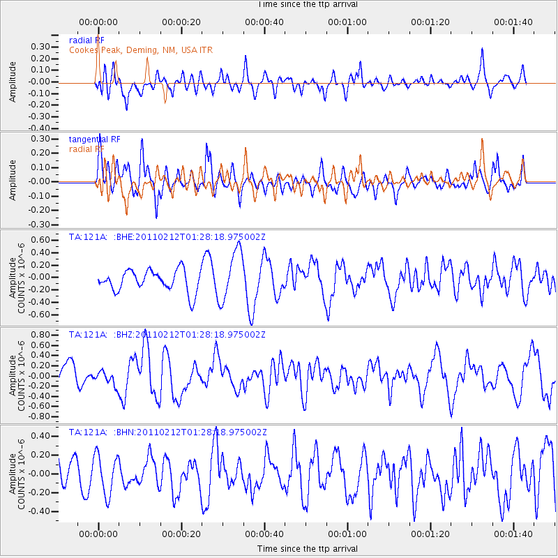
121A Cookes Peak, Deming, NM, USA - Earthquake Result Viewer
*The percent match for this event was below the threshold and hence no stack was calculated.
| Earthquake location: |
Central Chile |
| Earthquake latitude/longitude: |
-37.0/-73.0 |
| Earthquake time(UTC): |
2011/02/12 (043) 01:17:01 GMT |
| Earthquake Depth: |
16 km |
| Earthquake Magnitude: |
5.8 MS, 5.4 MB, 6.1 MW, 6.1 MW |
| Earthquake Catalog/Contributor: |
WHDF/NEIC |
|
| Network: |
TA USArray Transportable Network (new EarthScope stations) |
| Station: |
121A Cookes Peak, Deming, NM, USA |
| Lat/Lon: |
32.53 N/107.79 W |
| Elevation: |
1652 m |
|
| Distance: |
76.5 deg |
| Az: |
330.248 deg |
| Baz: |
151.956 deg |
| Ray Param: |
$rayparam |
*The percent match for this event was below the threshold and hence was not used in the summary stack. |
|
| Radial Match: |
53.631676 % |
| Radial Bump: |
400 |
| Transverse Match: |
62.833874 % |
| Transverse Bump: |
400 |
| SOD ConfigId: |
350818 |
| Insert Time: |
2011-07-26 06:47:28.050 +0000 |
| GWidth: |
2.5 |
| Max Bumps: |
400 |
| Tol: |
0.001 |
|
Signal To Noise
| Channel | StoN | STA | LTA |
| TA:121A: :BHZ:20110212T01:28:18.975002Z | 0.55125403 | 1.4926168E-7 | 2.7076752E-7 |
| TA:121A: :BHN:20110212T01:28:18.975002Z | 1.5240672 | 2.1588177E-7 | 1.4164847E-7 |
| TA:121A: :BHE:20110212T01:28:18.975002Z | 2.4124691 | 4.1392948E-7 | 1.7157917E-7 |
| Arrivals |
| Ps | |
| PpPs | |
| PsPs/PpSs | |


