You are here: Home > Network List > TA - USArray Transportable Network (new EarthScope stations) Stations List
> Station T25A Trinidad, CO, USA > Earthquake Result Viewer
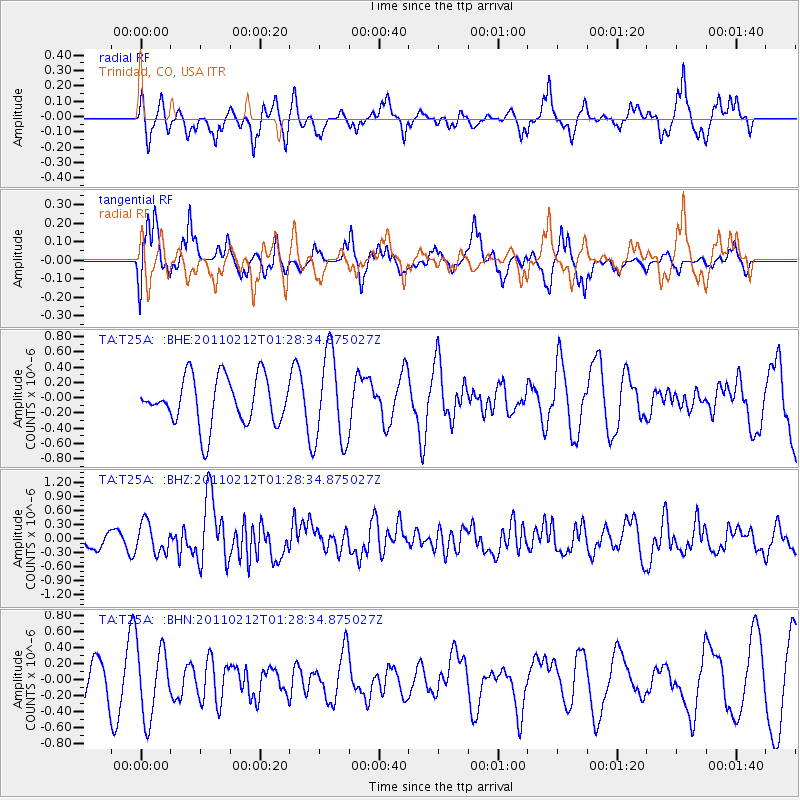
T25A Trinidad, CO, USA - Earthquake Result Viewer
*The percent match for this event was below the threshold and hence no stack was calculated.
| Earthquake location: |
Central Chile |
| Earthquake latitude/longitude: |
-37.0/-73.0 |
| Earthquake time(UTC): |
2011/02/12 (043) 01:17:01 GMT |
| Earthquake Depth: |
16 km |
| Earthquake Magnitude: |
5.8 MS, 5.4 MB, 6.1 MW, 6.1 MW |
| Earthquake Catalog/Contributor: |
WHDF/NEIC |
|
| Network: |
TA USArray Transportable Network (new EarthScope stations) |
| Station: |
T25A Trinidad, CO, USA |
| Lat/Lon: |
37.14 N/104.41 W |
| Elevation: |
2017 m |
|
| Distance: |
79.3 deg |
| Az: |
334.89 deg |
| Baz: |
154.851 deg |
| Ray Param: |
$rayparam |
*The percent match for this event was below the threshold and hence was not used in the summary stack. |
|
| Radial Match: |
60.135006 % |
| Radial Bump: |
374 |
| Transverse Match: |
61.97878 % |
| Transverse Bump: |
400 |
| SOD ConfigId: |
350818 |
| Insert Time: |
2011-07-26 06:47:37.626 +0000 |
| GWidth: |
2.5 |
| Max Bumps: |
400 |
| Tol: |
0.001 |
|
Signal To Noise
| Channel | StoN | STA | LTA |
| TA:T25A: :BHZ:20110212T01:28:34.875027Z | 1.484164 | 3.2154622E-7 | 2.166514E-7 |
| TA:T25A: :BHN:20110212T01:28:34.875027Z | 2.193886 | 4.426449E-7 | 2.0176294E-7 |
| TA:T25A: :BHE:20110212T01:28:34.875027Z | 1.8898209 | 5.8727426E-7 | 3.1075655E-7 |
| Arrivals |
| Ps | |
| PpPs | |
| PsPs/PpSs | |


