You are here: Home > Network List > TA - USArray Transportable Network (new EarthScope stations) Stations List
> Station J01D Myrtle Point, OR, USA > Earthquake Result Viewer
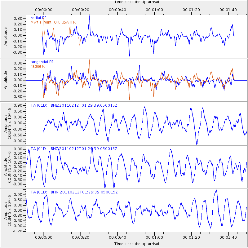
J01D Myrtle Point, OR, USA - Earthquake Result Viewer
*The percent match for this event was below the threshold and hence no stack was calculated.
| Earthquake location: |
Central Chile |
| Earthquake latitude/longitude: |
-37.0/-73.0 |
| Earthquake time(UTC): |
2011/02/12 (043) 01:17:01 GMT |
| Earthquake Depth: |
16 km |
| Earthquake Magnitude: |
5.8 MS, 5.4 MB, 6.1 MW, 6.1 MW |
| Earthquake Catalog/Contributor: |
WHDF/NEIC |
|
| Network: |
TA USArray Transportable Network (new EarthScope stations) |
| Station: |
J01D Myrtle Point, OR, USA |
| Lat/Lon: |
43.16 N/123.93 W |
| Elevation: |
131 m |
|
| Distance: |
92.3 deg |
| Az: |
325.325 deg |
| Baz: |
141.52 deg |
| Ray Param: |
$rayparam |
*The percent match for this event was below the threshold and hence was not used in the summary stack. |
|
| Radial Match: |
54.747795 % |
| Radial Bump: |
400 |
| Transverse Match: |
69.17329 % |
| Transverse Bump: |
400 |
| SOD ConfigId: |
350818 |
| Insert Time: |
2011-07-26 06:52:49.018 +0000 |
| GWidth: |
2.5 |
| Max Bumps: |
400 |
| Tol: |
0.001 |
|
Signal To Noise
| Channel | StoN | STA | LTA |
| TA:J01D: :BHZ:20110212T01:29:39.050015Z | 1.4950429 | 5.1575967E-7 | 3.4497987E-7 |
| TA:J01D: :BHN:20110212T01:29:39.050015Z | 2.1352909 | 6.436887E-7 | 3.0145245E-7 |
| TA:J01D: :BHE:20110212T01:29:39.050015Z | 2.478515 | 4.8976153E-7 | 1.9760282E-7 |
| Arrivals |
| Ps | |
| PpPs | |
| PsPs/PpSs | |


