You are here: Home > Network List > IU - Global Seismograph Network (GSN - IRIS/USGS) Stations List
> Station SLBS Sierra la Laguna Baja California Sur, Mexico > Earthquake Result Viewer
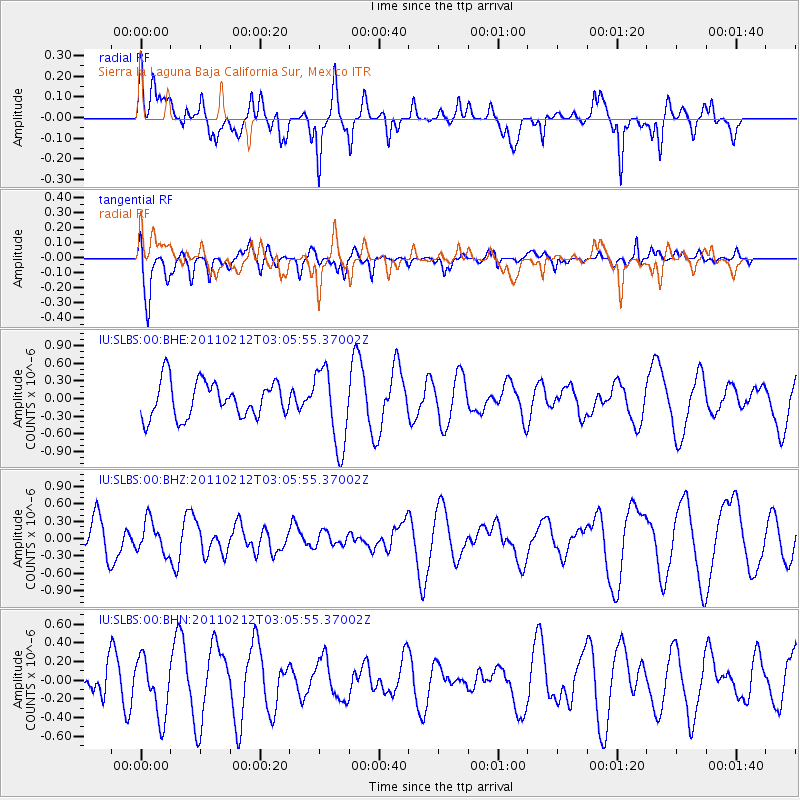
SLBS Sierra la Laguna Baja California Sur, Mexico - Earthquake Result Viewer
*The percent match for this event was below the threshold and hence no stack was calculated.
| Earthquake location: |
North Of Ascension Island |
| Earthquake latitude/longitude: |
0.1/-17.0 |
| Earthquake time(UTC): |
2011/02/12 (043) 02:53:15 GMT |
| Earthquake Depth: |
10 km |
| Earthquake Magnitude: |
5.5 MB, 5.6 MW |
| Earthquake Catalog/Contributor: |
WHDF/NEIC |
|
| Network: |
IU Global Seismograph Network (GSN - IRIS/USGS) |
| Station: |
SLBS Sierra la Laguna Baja California Sur, Mexico |
| Lat/Lon: |
23.69 N/109.94 W |
| Elevation: |
825 m |
|
| Distance: |
92.7 deg |
| Az: |
293.575 deg |
| Baz: |
88.758 deg |
| Ray Param: |
$rayparam |
*The percent match for this event was below the threshold and hence was not used in the summary stack. |
|
| Radial Match: |
55.593296 % |
| Radial Bump: |
400 |
| Transverse Match: |
43.66883 % |
| Transverse Bump: |
400 |
| SOD ConfigId: |
350818 |
| Insert Time: |
2011-07-26 07:01:12.061 +0000 |
| GWidth: |
2.5 |
| Max Bumps: |
400 |
| Tol: |
0.001 |
|
Signal To Noise
| Channel | StoN | STA | LTA |
| IU:SLBS:00:BHZ:20110212T03:05:55.37002Z | 0.58363205 | 2.7416888E-7 | 4.6976322E-7 |
| IU:SLBS:00:BHN:20110212T03:05:55.37002Z | 1.3971909 | 3.1773877E-7 | 2.2741256E-7 |
| IU:SLBS:00:BHE:20110212T03:05:55.37002Z | 2.1795683 | 6.641677E-7 | 3.0472444E-7 |
| Arrivals |
| Ps | |
| PpPs | |
| PsPs/PpSs | |


