You are here: Home > Network List > TA - USArray Transportable Network (new EarthScope stations) Stations List
> Station 335A Moody, TX, USA > Earthquake Result Viewer
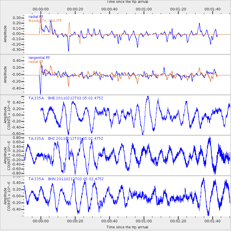
335A Moody, TX, USA - Earthquake Result Viewer
*The percent match for this event was below the threshold and hence no stack was calculated.
| Earthquake location: |
North Of Ascension Island |
| Earthquake latitude/longitude: |
0.1/-17.0 |
| Earthquake time(UTC): |
2011/02/12 (043) 02:53:15 GMT |
| Earthquake Depth: |
10 km |
| Earthquake Magnitude: |
5.5 MB, 5.6 MW |
| Earthquake Catalog/Contributor: |
WHDF/NEIC |
|
| Network: |
TA USArray Transportable Network (new EarthScope stations) |
| Station: |
335A Moody, TX, USA |
| Lat/Lon: |
31.28 N/97.43 W |
| Elevation: |
217 m |
|
| Distance: |
81.8 deg |
| Az: |
301.46 deg |
| Baz: |
94.922 deg |
| Ray Param: |
$rayparam |
*The percent match for this event was below the threshold and hence was not used in the summary stack. |
|
| Radial Match: |
59.10822 % |
| Radial Bump: |
400 |
| Transverse Match: |
52.6154 % |
| Transverse Bump: |
400 |
| SOD ConfigId: |
350818 |
| Insert Time: |
2011-07-26 07:06:44.421 +0000 |
| GWidth: |
2.5 |
| Max Bumps: |
400 |
| Tol: |
0.001 |
|
Signal To Noise
| Channel | StoN | STA | LTA |
| TA:335A: :BHZ:20110212T03:05:02.475Z | 0.3250264 | 9.066742E-8 | 2.7895402E-7 |
| TA:335A: :BHN:20110212T03:05:02.475Z | 0.9493598 | 1.8278759E-7 | 1.9253774E-7 |
| TA:335A: :BHE:20110212T03:05:02.475Z | 1.1649089 | 2.8774127E-7 | 2.4700753E-7 |
| Arrivals |
| Ps | |
| PpPs | |
| PsPs/PpSs | |


