You are here: Home > Network List > TA - USArray Transportable Network (new EarthScope stations) Stations List
> Station H34A Spellman Lake, Hanley Falls, MN, USA > Earthquake Result Viewer
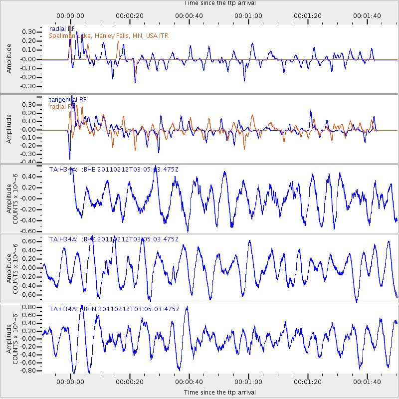
H34A Spellman Lake, Hanley Falls, MN, USA - Earthquake Result Viewer
*The percent match for this event was below the threshold and hence no stack was calculated.
| Earthquake location: |
North Of Ascension Island |
| Earthquake latitude/longitude: |
0.1/-17.0 |
| Earthquake time(UTC): |
2011/02/12 (043) 02:53:15 GMT |
| Earthquake Depth: |
10 km |
| Earthquake Magnitude: |
5.5 MB, 5.6 MW |
| Earthquake Catalog/Contributor: |
WHDF/NEIC |
|
| Network: |
TA USArray Transportable Network (new EarthScope stations) |
| Station: |
H34A Spellman Lake, Hanley Falls, MN, USA |
| Lat/Lon: |
44.67 N/95.78 W |
| Elevation: |
329 m |
|
| Distance: |
81.9 deg |
| Az: |
315.022 deg |
| Baz: |
97.871 deg |
| Ray Param: |
$rayparam |
*The percent match for this event was below the threshold and hence was not used in the summary stack. |
|
| Radial Match: |
62.196865 % |
| Radial Bump: |
400 |
| Transverse Match: |
44.488354 % |
| Transverse Bump: |
400 |
| SOD ConfigId: |
350818 |
| Insert Time: |
2011-07-26 07:08:48.933 +0000 |
| GWidth: |
2.5 |
| Max Bumps: |
400 |
| Tol: |
0.001 |
|
Signal To Noise
| Channel | StoN | STA | LTA |
| TA:H34A: :BHZ:20110212T03:05:03.475Z | 1.0084226 | 2.6904755E-7 | 2.668004E-7 |
| TA:H34A: :BHN:20110212T03:05:03.475Z | 2.4220994 | 5.815291E-7 | 2.4009302E-7 |
| TA:H34A: :BHE:20110212T03:05:03.475Z | 1.3958517 | 2.846425E-7 | 2.039203E-7 |
| Arrivals |
| Ps | |
| PpPs | |
| PsPs/PpSs | |


