You are here: Home > Network List > TA - USArray Transportable Network (new EarthScope stations) Stations List
> Station 334A Lometa, TX, USA > Earthquake Result Viewer
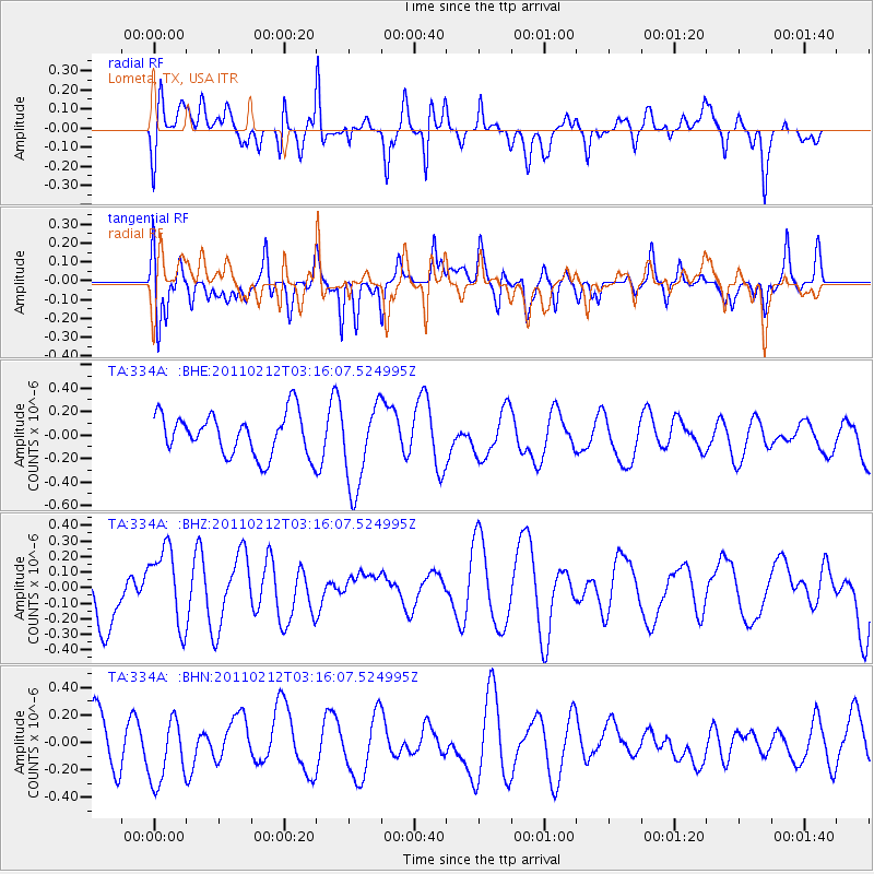
334A Lometa, TX, USA - Earthquake Result Viewer
*The percent match for this event was below the threshold and hence no stack was calculated.
| Earthquake location: |
Kermadec Islands Region |
| Earthquake latitude/longitude: |
-31.2/-177.8 |
| Earthquake time(UTC): |
2011/02/12 (043) 03:03:04 GMT |
| Earthquake Depth: |
10 km |
| Earthquake Magnitude: |
5.7 MS, 5.2 MB, 5.6 MW |
| Earthquake Catalog/Contributor: |
WHDF/NEIC |
|
| Network: |
TA USArray Transportable Network (new EarthScope stations) |
| Station: |
334A Lometa, TX, USA |
| Lat/Lon: |
31.33 N/98.24 W |
| Elevation: |
389 m |
|
| Distance: |
97.7 deg |
| Az: |
58.133 deg |
| Baz: |
238.222 deg |
| Ray Param: |
$rayparam |
*The percent match for this event was below the threshold and hence was not used in the summary stack. |
|
| Radial Match: |
54.167503 % |
| Radial Bump: |
400 |
| Transverse Match: |
47.86892 % |
| Transverse Bump: |
400 |
| SOD ConfigId: |
350818 |
| Insert Time: |
2011-07-26 07:20:45.571 +0000 |
| GWidth: |
2.5 |
| Max Bumps: |
400 |
| Tol: |
0.001 |
|
Signal To Noise
| Channel | StoN | STA | LTA |
| TA:334A: :BHZ:20110212T03:16:07.524995Z | 1.2993555 | 2.49064E-7 | 1.9168272E-7 |
| TA:334A: :BHN:20110212T03:16:07.524995Z | 1.4228213 | 2.4389345E-7 | 1.714154E-7 |
| TA:334A: :BHE:20110212T03:16:07.524995Z | 2.0455272 | 3.62467E-7 | 1.7719978E-7 |
| Arrivals |
| Ps | |
| PpPs | |
| PsPs/PpSs | |


