You are here: Home > Network List > UW - Pacific Northwest Regional Seismic Network Stations List
> Station WOLL Wollman Farm, Schrag, WA, USA > Earthquake Result Viewer
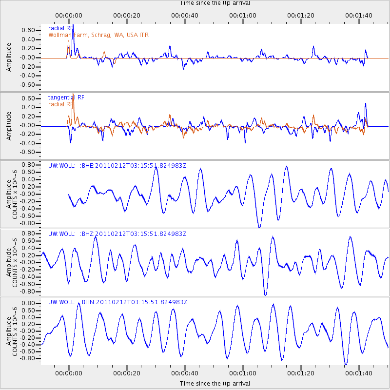
WOLL Wollman Farm, Schrag, WA, USA - Earthquake Result Viewer
*The percent match for this event was below the threshold and hence no stack was calculated.
| Earthquake location: |
Kermadec Islands Region |
| Earthquake latitude/longitude: |
-31.2/-177.8 |
| Earthquake time(UTC): |
2011/02/12 (043) 03:03:04 GMT |
| Earthquake Depth: |
10 km |
| Earthquake Magnitude: |
5.7 MS, 5.2 MB, 5.6 MW |
| Earthquake Catalog/Contributor: |
WHDF/NEIC |
|
| Network: |
UW Pacific Northwest Regional Seismic Network |
| Station: |
WOLL Wollman Farm, Schrag, WA, USA |
| Lat/Lon: |
47.06 N/118.92 W |
| Elevation: |
385 m |
|
| Distance: |
94.2 deg |
| Az: |
35.943 deg |
| Baz: |
227.336 deg |
| Ray Param: |
$rayparam |
*The percent match for this event was below the threshold and hence was not used in the summary stack. |
|
| Radial Match: |
70.81259 % |
| Radial Bump: |
318 |
| Transverse Match: |
61.94531 % |
| Transverse Bump: |
333 |
| SOD ConfigId: |
350818 |
| Insert Time: |
2011-07-26 07:22:02.920 +0000 |
| GWidth: |
2.5 |
| Max Bumps: |
400 |
| Tol: |
0.001 |
|
Signal To Noise
| Channel | StoN | STA | LTA |
| UW:WOLL: :BHZ:20110212T03:15:51.824983Z | 0.97435033 | 3.1105418E-7 | 3.1924264E-7 |
| UW:WOLL: :BHN:20110212T03:15:51.824983Z | 2.0240147 | 5.4024014E-7 | 2.6691512E-7 |
| UW:WOLL: :BHE:20110212T03:15:51.824983Z | 2.5881066 | 4.4888958E-7 | 1.7344324E-7 |
| Arrivals |
| Ps | |
| PpPs | |
| PsPs/PpSs | |


