You are here: Home > Network List > CI - Caltech Regional Seismic Network Stations List
> Station MLAC Mammoth Lakes, California, USA > Earthquake Result Viewer
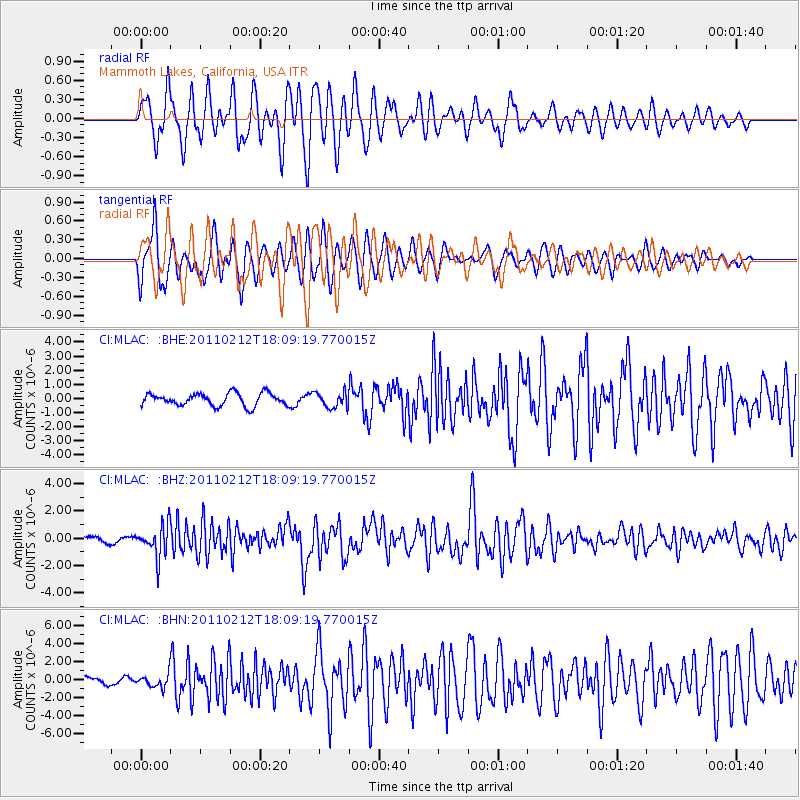
MLAC Mammoth Lakes, California, USA - Earthquake Result Viewer
*The percent match for this event was below the threshold and hence no stack was calculated.
| Earthquake location: |
Tonga Islands |
| Earthquake latitude/longitude: |
-20.9/-175.7 |
| Earthquake time(UTC): |
2011/02/12 (043) 17:57:56 GMT |
| Earthquake Depth: |
90 km |
| Earthquake Magnitude: |
6.0 MB, 6.1 MW, 6.1 MW |
| Earthquake Catalog/Contributor: |
WHDF/NEIC |
|
| Network: |
CI Caltech Regional Seismic Network |
| Station: |
MLAC Mammoth Lakes, California, USA |
| Lat/Lon: |
37.63 N/118.84 W |
| Elevation: |
2134 m |
|
| Distance: |
79.0 deg |
| Az: |
42.613 deg |
| Baz: |
232.882 deg |
| Ray Param: |
$rayparam |
*The percent match for this event was below the threshold and hence was not used in the summary stack. |
|
| Radial Match: |
80.30164 % |
| Radial Bump: |
400 |
| Transverse Match: |
72.6157 % |
| Transverse Bump: |
400 |
| SOD ConfigId: |
350818 |
| Insert Time: |
2011-07-26 07:42:01.599 +0000 |
| GWidth: |
2.5 |
| Max Bumps: |
400 |
| Tol: |
0.001 |
|
Signal To Noise
| Channel | StoN | STA | LTA |
| CI:MLAC: :BHZ:20110212T18:09:19.770015Z | 5.3018427 | 1.1625662E-6 | 2.1927588E-7 |
| CI:MLAC: :BHN:20110212T18:09:19.770015Z | 1.8701442 | 7.02887E-7 | 3.758464E-7 |
| CI:MLAC: :BHE:20110212T18:09:19.770015Z | 1.217508 | 5.393258E-7 | 4.429752E-7 |
| Arrivals |
| Ps | |
| PpPs | |
| PsPs/PpSs | |


