You are here: Home > Network List > CI - Caltech Regional Seismic Network Stations List
> Station CIA CIA, Avalon Catalina Island, CA, USA > Earthquake Result Viewer
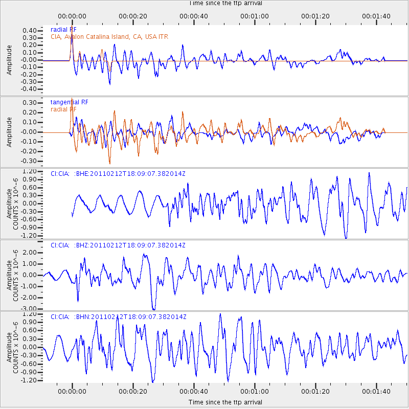
CIA CIA, Avalon Catalina Island, CA, USA - Earthquake Result Viewer
*The percent match for this event was below the threshold and hence no stack was calculated.
| Earthquake location: |
Tonga Islands |
| Earthquake latitude/longitude: |
-20.9/-175.7 |
| Earthquake time(UTC): |
2011/02/12 (043) 17:57:56 GMT |
| Earthquake Depth: |
90 km |
| Earthquake Magnitude: |
6.0 MB, 6.1 MW, 6.1 MW |
| Earthquake Catalog/Contributor: |
WHDF/NEIC |
|
| Network: |
CI Caltech Regional Seismic Network |
| Station: |
CIA CIA, Avalon Catalina Island, CA, USA |
| Lat/Lon: |
33.40 N/118.41 W |
| Elevation: |
467 m |
|
| Distance: |
76.8 deg |
| Az: |
46.287 deg |
| Baz: |
233.898 deg |
| Ray Param: |
$rayparam |
*The percent match for this event was below the threshold and hence was not used in the summary stack. |
|
| Radial Match: |
73.34786 % |
| Radial Bump: |
400 |
| Transverse Match: |
64.37315 % |
| Transverse Bump: |
400 |
| SOD ConfigId: |
350818 |
| Insert Time: |
2011-07-26 07:44:09.969 +0000 |
| GWidth: |
2.5 |
| Max Bumps: |
400 |
| Tol: |
0.001 |
|
Signal To Noise
| Channel | StoN | STA | LTA |
| CI:CIA: :BHZ:20110212T18:09:07.382014Z | 5.363228 | 8.939825E-7 | 1.666874E-7 |
| CI:CIA: :BHN:20110212T18:09:07.382014Z | 2.3840842 | 3.542457E-7 | 1.4858776E-7 |
| CI:CIA: :BHE:20110212T18:09:07.382014Z | 1.1109327 | 2.748497E-7 | 2.4740444E-7 |
| Arrivals |
| Ps | |
| PpPs | |
| PsPs/PpSs | |


