You are here: Home > Network List > CI - Caltech Regional Seismic Network Stations List
> Station RCT Rector, Visalia, CA, USA > Earthquake Result Viewer
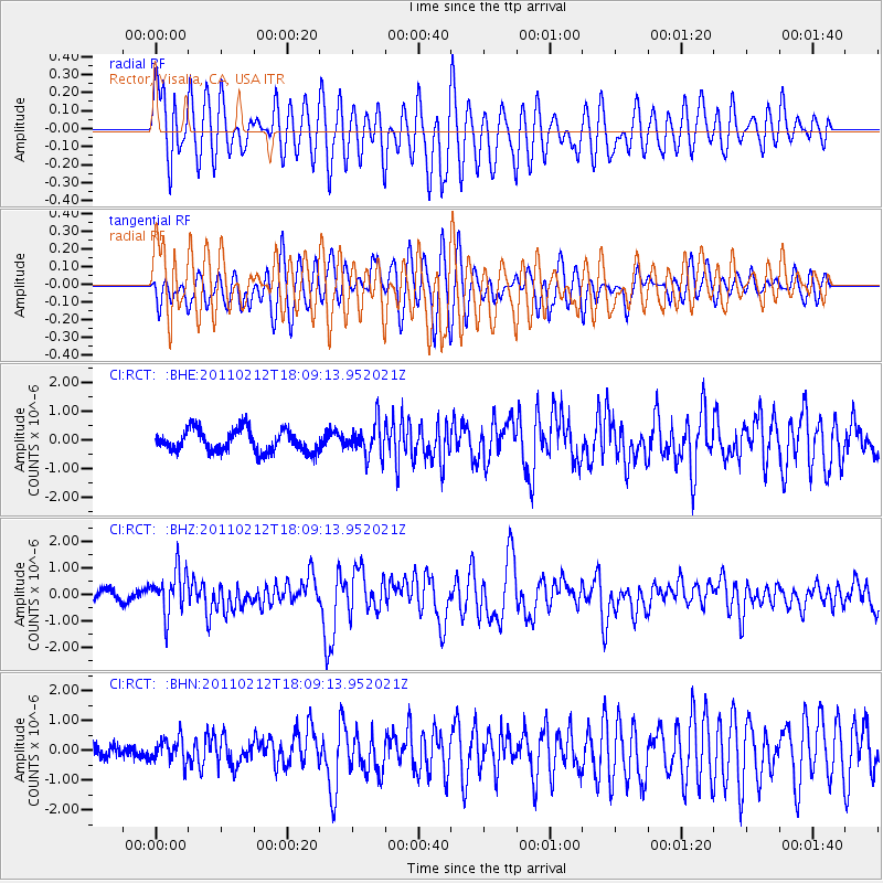
RCT Rector, Visalia, CA, USA - Earthquake Result Viewer
*The percent match for this event was below the threshold and hence no stack was calculated.
| Earthquake location: |
Tonga Islands |
| Earthquake latitude/longitude: |
-20.9/-175.7 |
| Earthquake time(UTC): |
2011/02/12 (043) 17:57:56 GMT |
| Earthquake Depth: |
90 km |
| Earthquake Magnitude: |
6.0 MB, 6.1 MW, 6.1 MW |
| Earthquake Catalog/Contributor: |
WHDF/NEIC |
|
| Network: |
CI Caltech Regional Seismic Network |
| Station: |
RCT Rector, Visalia, CA, USA |
| Lat/Lon: |
36.31 N/119.24 W |
| Elevation: |
107 m |
|
| Distance: |
78.0 deg |
| Az: |
43.487 deg |
| Baz: |
232.813 deg |
| Ray Param: |
$rayparam |
*The percent match for this event was below the threshold and hence was not used in the summary stack. |
|
| Radial Match: |
69.80695 % |
| Radial Bump: |
400 |
| Transverse Match: |
66.46531 % |
| Transverse Bump: |
400 |
| SOD ConfigId: |
350818 |
| Insert Time: |
2011-07-26 07:46:14.985 +0000 |
| GWidth: |
2.5 |
| Max Bumps: |
400 |
| Tol: |
0.001 |
|
Signal To Noise
| Channel | StoN | STA | LTA |
| CI:RCT: :BHZ:20110212T18:09:13.952021Z | 2.8066828 | 8.5113214E-7 | 3.0325197E-7 |
| CI:RCT: :BHN:20110212T18:09:13.952021Z | 2.1248798 | 4.0131084E-7 | 1.8886283E-7 |
| CI:RCT: :BHE:20110212T18:09:13.952021Z | 1.435666 | 5.525707E-7 | 3.8488807E-7 |
| Arrivals |
| Ps | |
| PpPs | |
| PsPs/PpSs | |


