You are here: Home > Network List > KN - Kyrgyz Seismic Telemetry Network Stations List
> Station CHM KN.CHM > Earthquake Result Viewer
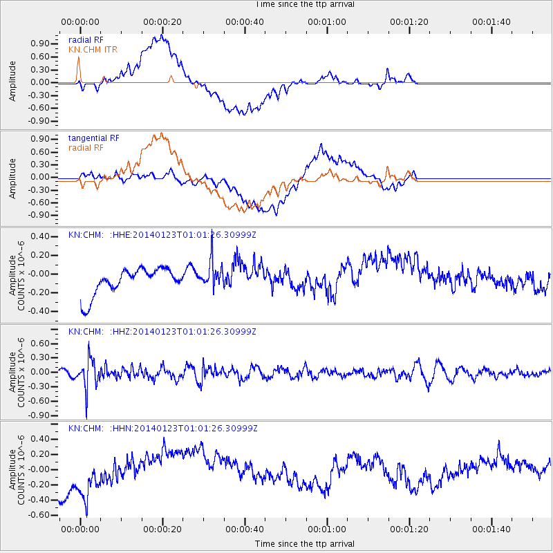
CHM KN.CHM - Earthquake Result Viewer
*The percent match for this event was below the threshold and hence no stack was calculated.
| Earthquake location: |
Flores Sea |
| Earthquake latitude/longitude: |
-7.1/120.3 |
| Earthquake time(UTC): |
2014/01/23 (023) 00:52:15 GMT |
| Earthquake Depth: |
579 km |
| Earthquake Magnitude: |
5.5 MWB, 5.5 MWC |
| Earthquake Catalog/Contributor: |
NEIC PDE/NEIC COMCAT |
|
| Network: |
KN Kyrgyz Seismic Telemetry Network |
| Station: |
CHM KN.CHM |
| Lat/Lon: |
43.00 N/74.75 E |
| Elevation: |
655 m |
|
| Distance: |
64.8 deg |
| Az: |
324.613 deg |
| Baz: |
128.432 deg |
| Ray Param: |
$rayparam |
*The percent match for this event was below the threshold and hence was not used in the summary stack. |
|
| Radial Match: |
47.19885 % |
| Radial Bump: |
400 |
| Transverse Match: |
47.790264 % |
| Transverse Bump: |
400 |
| SOD ConfigId: |
3390531 |
| Insert Time: |
2019-04-10 02:03:13.607 +0000 |
| GWidth: |
2.5 |
| Max Bumps: |
400 |
| Tol: |
0.001 |
|
Signal To Noise
| Channel | StoN | STA | LTA |
| KN:CHM: :HHZ:20140123T01:01:26.30999Z | 3.5458574 | 2.9784465E-7 | 8.399792E-8 |
| KN:CHM: :HHN:20140123T01:01:26.30999Z | 1.3849683 | 3.060871E-7 | 2.2100657E-7 |
| KN:CHM: :HHE:20140123T01:01:26.30999Z | 1.0722601 | 1.4587627E-7 | 1.360456E-7 |
| Arrivals |
| Ps | |
| PpPs | |
| PsPs/PpSs | |


