You are here: Home > Network List > GT - Global Telemetered Seismograph Network (USAF/USGS) Stations List
> Station PLCA Paso Flores, Argentina > Earthquake Result Viewer
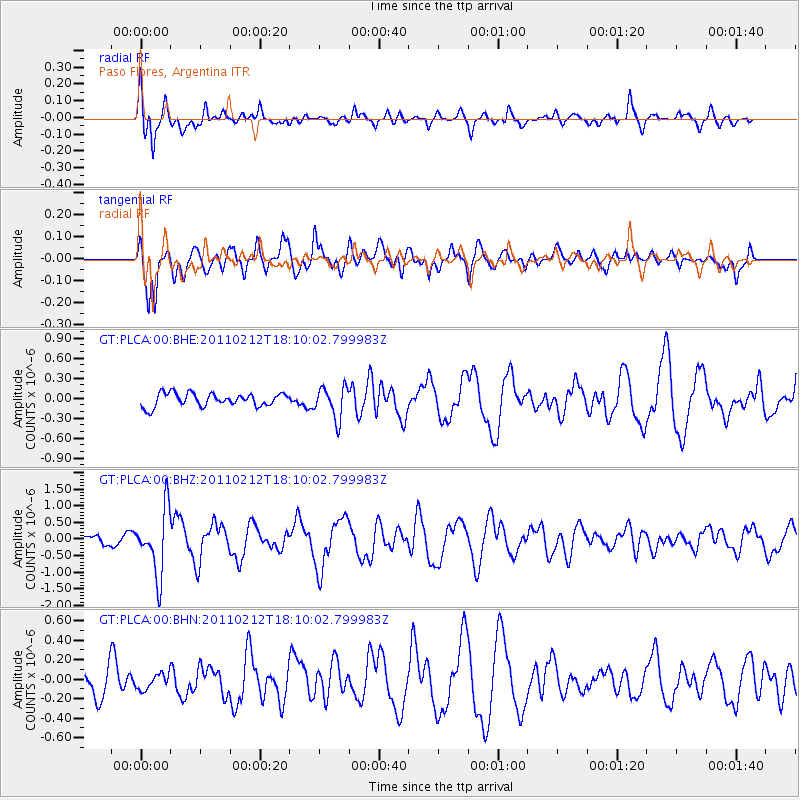
PLCA Paso Flores, Argentina - Earthquake Result Viewer
*The percent match for this event was below the threshold and hence no stack was calculated.
| Earthquake location: |
Tonga Islands |
| Earthquake latitude/longitude: |
-20.9/-175.7 |
| Earthquake time(UTC): |
2011/02/12 (043) 17:57:56 GMT |
| Earthquake Depth: |
90 km |
| Earthquake Magnitude: |
6.0 MB, 6.1 MW, 6.1 MW |
| Earthquake Catalog/Contributor: |
WHDF/NEIC |
|
| Network: |
GT Global Telemetered Seismograph Network (USAF/USGS) |
| Station: |
PLCA Paso Flores, Argentina |
| Lat/Lon: |
40.73 S/70.55 W |
| Elevation: |
1050 m |
|
| Distance: |
87.4 deg |
| Az: |
132.747 deg |
| Baz: |
244.638 deg |
| Ray Param: |
$rayparam |
*The percent match for this event was below the threshold and hence was not used in the summary stack. |
|
| Radial Match: |
76.59162 % |
| Radial Bump: |
400 |
| Transverse Match: |
58.902264 % |
| Transverse Bump: |
400 |
| SOD ConfigId: |
350818 |
| Insert Time: |
2011-07-26 07:54:46.545 +0000 |
| GWidth: |
2.5 |
| Max Bumps: |
400 |
| Tol: |
0.001 |
|
Signal To Noise
| Channel | StoN | STA | LTA |
| GT:PLCA:00:BHZ:20110212T18:10:02.799983Z | 6.619047 | 9.64657E-7 | 1.4573958E-7 |
| GT:PLCA:00:BHN:20110212T18:10:02.799983Z | 0.61613876 | 7.959311E-8 | 1.2918049E-7 |
| GT:PLCA:00:BHE:20110212T18:10:02.799983Z | 2.412025 | 2.3782157E-7 | 9.85983E-8 |
| Arrivals |
| Ps | |
| PpPs | |
| PsPs/PpSs | |


