You are here: Home > Network List > KN - Kyrgyz Seismic Telemetry Network Stations List
> Station ULHL - > Earthquake Result Viewer
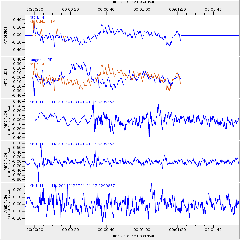
ULHL - - Earthquake Result Viewer
*The percent match for this event was below the threshold and hence no stack was calculated.
| Earthquake location: |
Flores Sea |
| Earthquake latitude/longitude: |
-7.1/120.3 |
| Earthquake time(UTC): |
2014/01/23 (023) 00:52:15 GMT |
| Earthquake Depth: |
579 km |
| Earthquake Magnitude: |
5.5 MWB, 5.5 MWC |
| Earthquake Catalog/Contributor: |
NEIC PDE/NEIC COMCAT |
|
| Network: |
KN Kyrgyz Seismic Telemetry Network |
| Station: |
ULHL - |
| Lat/Lon: |
42.25 N/76.24 E |
| Elevation: |
2040 m |
|
| Distance: |
63.4 deg |
| Az: |
324.732 deg |
| Baz: |
129.489 deg |
| Ray Param: |
$rayparam |
*The percent match for this event was below the threshold and hence was not used in the summary stack. |
|
| Radial Match: |
63.381454 % |
| Radial Bump: |
400 |
| Transverse Match: |
70.108284 % |
| Transverse Bump: |
400 |
| SOD ConfigId: |
3390531 |
| Insert Time: |
2019-04-10 02:03:17.391 +0000 |
| GWidth: |
2.5 |
| Max Bumps: |
400 |
| Tol: |
0.001 |
|
Signal To Noise
| Channel | StoN | STA | LTA |
| KN:ULHL: :HHZ:20140123T01:01:17.929985Z | 3.799578 | 3.325078E-7 | 8.751177E-8 |
| KN:ULHL: :HHN:20140123T01:01:17.929985Z | 1.1611203 | 1.07317696E-7 | 9.242599E-8 |
| KN:ULHL: :HHE:20140123T01:01:17.929985Z | 1.866763 | 1.4353455E-7 | 7.6889535E-8 |
| Arrivals |
| Ps | |
| PpPs | |
| PsPs/PpSs | |


