You are here: Home > Network List > TA - USArray Transportable Network (new EarthScope stations) Stations List
> Station H29A Onida, SD, USA > Earthquake Result Viewer
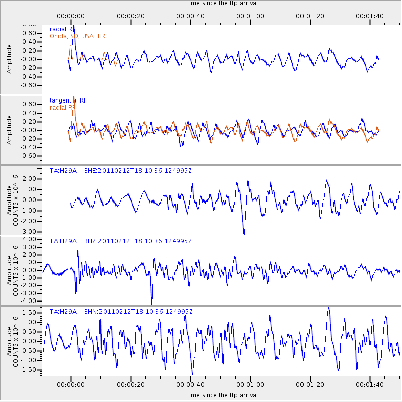
H29A Onida, SD, USA - Earthquake Result Viewer
*The percent match for this event was below the threshold and hence no stack was calculated.
| Earthquake location: |
Tonga Islands |
| Earthquake latitude/longitude: |
-20.9/-175.7 |
| Earthquake time(UTC): |
2011/02/12 (043) 17:57:56 GMT |
| Earthquake Depth: |
90 km |
| Earthquake Magnitude: |
6.0 MB, 6.1 MW, 6.1 MW |
| Earthquake Catalog/Contributor: |
WHDF/NEIC |
|
| Network: |
TA USArray Transportable Network (new EarthScope stations) |
| Station: |
H29A Onida, SD, USA |
| Lat/Lon: |
44.63 N/100.21 W |
| Elevation: |
548 m |
|
| Distance: |
94.6 deg |
| Az: |
43.903 deg |
| Baz: |
245.242 deg |
| Ray Param: |
$rayparam |
*The percent match for this event was below the threshold and hence was not used in the summary stack. |
|
| Radial Match: |
62.48354 % |
| Radial Bump: |
400 |
| Transverse Match: |
62.076065 % |
| Transverse Bump: |
400 |
| SOD ConfigId: |
350818 |
| Insert Time: |
2011-07-26 08:27:18.336 +0000 |
| GWidth: |
2.5 |
| Max Bumps: |
400 |
| Tol: |
0.001 |
|
Signal To Noise
| Channel | StoN | STA | LTA |
| TA:H29A: :BHZ:20110212T18:10:36.124995Z | 3.199578 | 1.1349046E-6 | 3.5470444E-7 |
| TA:H29A: :BHN:20110212T18:10:36.124995Z | 0.9788578 | 5.0981123E-7 | 5.2082254E-7 |
| TA:H29A: :BHE:20110212T18:10:36.124995Z | 0.86670864 | 3.913919E-7 | 4.5158416E-7 |
| Arrivals |
| Ps | |
| PpPs | |
| PsPs/PpSs | |


