You are here: Home > Network List > TA - USArray Transportable Network (new EarthScope stations) Stations List
> Station 933A Laredo, TX, USA > Earthquake Result Viewer
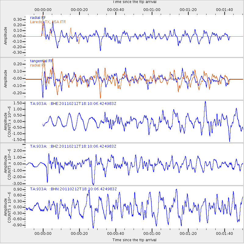
933A Laredo, TX, USA - Earthquake Result Viewer
*The percent match for this event was below the threshold and hence no stack was calculated.
| Earthquake location: |
Tonga Islands |
| Earthquake latitude/longitude: |
-20.9/-175.7 |
| Earthquake time(UTC): |
2011/02/12 (043) 17:57:56 GMT |
| Earthquake Depth: |
90 km |
| Earthquake Magnitude: |
6.0 MB, 6.1 MW, 6.1 MW |
| Earthquake Catalog/Contributor: |
WHDF/NEIC |
|
| Network: |
TA USArray Transportable Network (new EarthScope stations) |
| Station: |
933A Laredo, TX, USA |
| Lat/Lon: |
27.61 N/99.27 W |
| Elevation: |
214 m |
|
| Distance: |
88.2 deg |
| Az: |
59.646 deg |
| Baz: |
245.411 deg |
| Ray Param: |
$rayparam |
*The percent match for this event was below the threshold and hence was not used in the summary stack. |
|
| Radial Match: |
79.021416 % |
| Radial Bump: |
400 |
| Transverse Match: |
70.407486 % |
| Transverse Bump: |
400 |
| SOD ConfigId: |
350818 |
| Insert Time: |
2011-07-26 08:43:13.981 +0000 |
| GWidth: |
2.5 |
| Max Bumps: |
400 |
| Tol: |
0.001 |
|
Signal To Noise
| Channel | StoN | STA | LTA |
| TA:933A: :BHZ:20110212T18:10:06.424983Z | 5.512214 | 8.966237E-7 | 1.6266125E-7 |
| TA:933A: :BHN:20110212T18:10:06.424983Z | 0.4001 | 1.4270098E-7 | 3.566633E-7 |
| TA:933A: :BHE:20110212T18:10:06.424983Z | 0.8072949 | 3.0702077E-7 | 3.8030808E-7 |
| Arrivals |
| Ps | |
| PpPs | |
| PsPs/PpSs | |


