You are here: Home > Network List > TA - USArray Transportable Network (new EarthScope stations) Stations List
> Station 138A Matatall Enterprise, Big Sandy, TX, USA > Earthquake Result Viewer
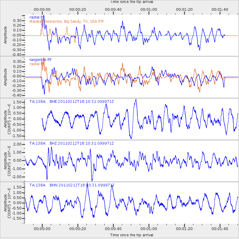
138A Matatall Enterprise, Big Sandy, TX, USA - Earthquake Result Viewer
*The percent match for this event was below the threshold and hence no stack was calculated.
| Earthquake location: |
Tonga Islands |
| Earthquake latitude/longitude: |
-20.9/-175.7 |
| Earthquake time(UTC): |
2011/02/12 (043) 17:57:56 GMT |
| Earthquake Depth: |
90 km |
| Earthquake Magnitude: |
6.0 MB, 6.1 MW, 6.1 MW |
| Earthquake Catalog/Contributor: |
WHDF/NEIC |
|
| Network: |
TA USArray Transportable Network (new EarthScope stations) |
| Station: |
138A Matatall Enterprise, Big Sandy, TX, USA |
| Lat/Lon: |
32.66 N/95.09 W |
| Elevation: |
143 m |
|
| Distance: |
93.5 deg |
| Az: |
56.484 deg |
| Baz: |
247.552 deg |
| Ray Param: |
$rayparam |
*The percent match for this event was below the threshold and hence was not used in the summary stack. |
|
| Radial Match: |
67.89797 % |
| Radial Bump: |
400 |
| Transverse Match: |
36.365 % |
| Transverse Bump: |
400 |
| SOD ConfigId: |
350818 |
| Insert Time: |
2011-07-26 08:49:10.709 +0000 |
| GWidth: |
2.5 |
| Max Bumps: |
400 |
| Tol: |
0.001 |
|
Signal To Noise
| Channel | StoN | STA | LTA |
| TA:138A: :BHZ:20110212T18:10:31.099971Z | 1.9506072 | 8.4729135E-7 | 4.343731E-7 |
| TA:138A: :BHN:20110212T18:10:31.099971Z | 0.75150466 | 5.8199674E-7 | 7.744419E-7 |
| TA:138A: :BHE:20110212T18:10:31.099971Z | 1.6712112 | 7.2942686E-7 | 4.36466E-7 |
| Arrivals |
| Ps | |
| PpPs | |
| PsPs/PpSs | |


