You are here: Home > Network List > TA - USArray Transportable Network (new EarthScope stations) Stations List
> Station X35A Drake, OK, USA > Earthquake Result Viewer
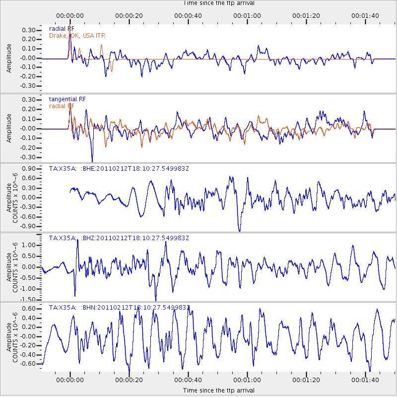
X35A Drake, OK, USA - Earthquake Result Viewer
*The percent match for this event was below the threshold and hence no stack was calculated.
| Earthquake location: |
Tonga Islands |
| Earthquake latitude/longitude: |
-20.9/-175.7 |
| Earthquake time(UTC): |
2011/02/12 (043) 17:57:56 GMT |
| Earthquake Depth: |
90 km |
| Earthquake Magnitude: |
6.0 MB, 6.1 MW, 6.1 MW |
| Earthquake Catalog/Contributor: |
WHDF/NEIC |
|
| Network: |
TA USArray Transportable Network (new EarthScope stations) |
| Station: |
X35A Drake, OK, USA |
| Lat/Lon: |
34.40 N/96.97 W |
| Elevation: |
300 m |
|
| Distance: |
92.7 deg |
| Az: |
54.27 deg |
| Baz: |
246.637 deg |
| Ray Param: |
$rayparam |
*The percent match for this event was below the threshold and hence was not used in the summary stack. |
|
| Radial Match: |
46.155544 % |
| Radial Bump: |
400 |
| Transverse Match: |
49.370495 % |
| Transverse Bump: |
400 |
| SOD ConfigId: |
350818 |
| Insert Time: |
2011-07-26 08:51:45.266 +0000 |
| GWidth: |
2.5 |
| Max Bumps: |
400 |
| Tol: |
0.001 |
|
Signal To Noise
| Channel | StoN | STA | LTA |
| TA:X35A: :BHZ:20110212T18:10:27.549983Z | 2.8662891 | 5.031704E-7 | 1.7554767E-7 |
| TA:X35A: :BHN:20110212T18:10:27.549983Z | 1.0520953 | 2.8571682E-7 | 2.7156932E-7 |
| TA:X35A: :BHE:20110212T18:10:27.549983Z | 1.4364244 | 3.0253798E-7 | 2.106188E-7 |
| Arrivals |
| Ps | |
| PpPs | |
| PsPs/PpSs | |


