You are here: Home > Network List > TA - USArray Transportable Network (new EarthScope stations) Stations List
> Station J31A Geddes, SD, USA > Earthquake Result Viewer
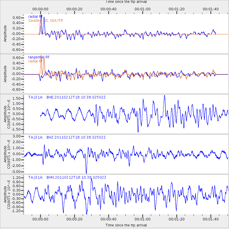
J31A Geddes, SD, USA - Earthquake Result Viewer
*The percent match for this event was below the threshold and hence no stack was calculated.
| Earthquake location: |
Tonga Islands |
| Earthquake latitude/longitude: |
-20.9/-175.7 |
| Earthquake time(UTC): |
2011/02/12 (043) 17:57:56 GMT |
| Earthquake Depth: |
90 km |
| Earthquake Magnitude: |
6.0 MB, 6.1 MW, 6.1 MW |
| Earthquake Catalog/Contributor: |
WHDF/NEIC |
|
| Network: |
TA USArray Transportable Network (new EarthScope stations) |
| Station: |
J31A Geddes, SD, USA |
| Lat/Lon: |
43.29 N/98.74 W |
| Elevation: |
491 m |
|
| Distance: |
95.0 deg |
| Az: |
45.563 deg |
| Baz: |
246.121 deg |
| Ray Param: |
$rayparam |
*The percent match for this event was below the threshold and hence was not used in the summary stack. |
|
| Radial Match: |
76.606766 % |
| Radial Bump: |
400 |
| Transverse Match: |
66.59376 % |
| Transverse Bump: |
400 |
| SOD ConfigId: |
350818 |
| Insert Time: |
2011-07-26 09:00:10.341 +0000 |
| GWidth: |
2.5 |
| Max Bumps: |
400 |
| Tol: |
0.001 |
|
Signal To Noise
| Channel | StoN | STA | LTA |
| TA:J31A: :BHZ:20110212T18:10:38.02502Z | 2.0257401 | 6.456069E-7 | 3.1870175E-7 |
| TA:J31A: :BHN:20110212T18:10:38.02502Z | 0.91844577 | 3.1616833E-7 | 3.4424278E-7 |
| TA:J31A: :BHE:20110212T18:10:38.02502Z | 1.5329373 | 4.9981105E-7 | 3.2604794E-7 |
| Arrivals |
| Ps | |
| PpPs | |
| PsPs/PpSs | |


