You are here: Home > Network List > US - United States National Seismic Network Stations List
> Station MVCO Mesa Verde, Colorado, USA > Earthquake Result Viewer
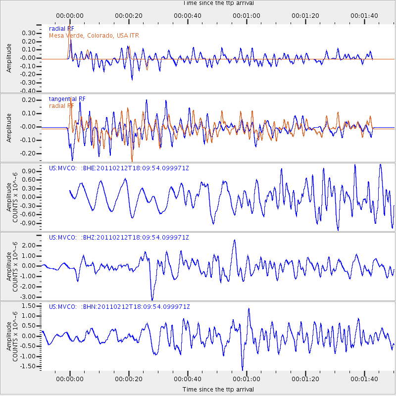
MVCO Mesa Verde, Colorado, USA - Earthquake Result Viewer
*The percent match for this event was below the threshold and hence no stack was calculated.
| Earthquake location: |
Tonga Islands |
| Earthquake latitude/longitude: |
-20.9/-175.7 |
| Earthquake time(UTC): |
2011/02/12 (043) 17:57:56 GMT |
| Earthquake Depth: |
90 km |
| Earthquake Magnitude: |
6.0 MB, 6.1 MW, 6.1 MW |
| Earthquake Catalog/Contributor: |
WHDF/NEIC |
|
| Network: |
US United States National Seismic Network |
| Station: |
MVCO Mesa Verde, Colorado, USA |
| Lat/Lon: |
37.21 N/108.50 W |
| Elevation: |
2170 m |
|
| Distance: |
85.6 deg |
| Az: |
47.561 deg |
| Baz: |
239.811 deg |
| Ray Param: |
$rayparam |
*The percent match for this event was below the threshold and hence was not used in the summary stack. |
|
| Radial Match: |
57.891415 % |
| Radial Bump: |
400 |
| Transverse Match: |
71.86598 % |
| Transverse Bump: |
400 |
| SOD ConfigId: |
350818 |
| Insert Time: |
2011-07-26 09:15:57.065 +0000 |
| GWidth: |
2.5 |
| Max Bumps: |
400 |
| Tol: |
0.001 |
|
Signal To Noise
| Channel | StoN | STA | LTA |
| US:MVCO: :BHZ:20110212T18:09:54.099971Z | 2.7945318 | 6.1653566E-7 | 2.2062217E-7 |
| US:MVCO: :BHN:20110212T18:09:54.099971Z | 0.73787755 | 1.4221062E-7 | 1.927293E-7 |
| US:MVCO: :BHE:20110212T18:09:54.099971Z | 1.152172 | 4.041713E-7 | 3.5079077E-7 |
| Arrivals |
| Ps | |
| PpPs | |
| PsPs/PpSs | |


