You are here: Home > Network List > TA - USArray Transportable Network (new EarthScope stations) Stations List
> Station G29A Hoven, SD, USA > Earthquake Result Viewer
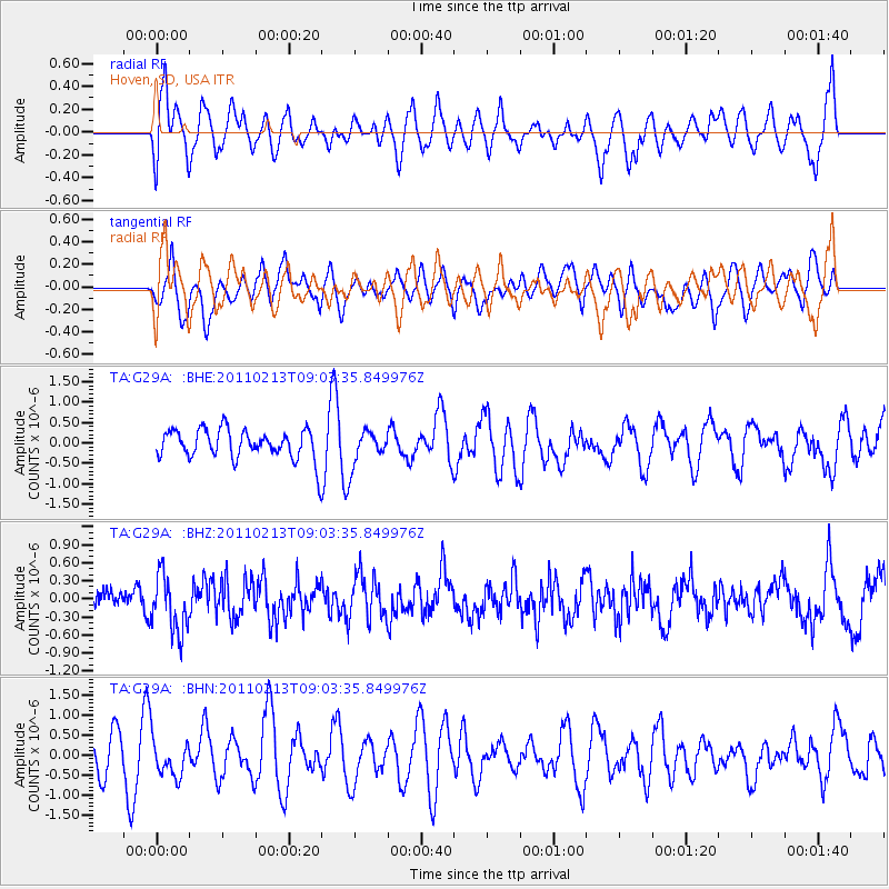
G29A Hoven, SD, USA - Earthquake Result Viewer
*The percent match for this event was below the threshold and hence no stack was calculated.
| Earthquake location: |
Near Coast Of Central Chile |
| Earthquake latitude/longitude: |
-36.6/-73.2 |
| Earthquake time(UTC): |
2011/02/13 (044) 08:51:34 GMT |
| Earthquake Depth: |
21 km |
| Earthquake Magnitude: |
5.7 MS, 5.4 MB, 5.9 MW, 5.8 MW |
| Earthquake Catalog/Contributor: |
WHDF/NEIC |
|
| Network: |
TA USArray Transportable Network (new EarthScope stations) |
| Station: |
G29A Hoven, SD, USA |
| Lat/Lon: |
45.19 N/99.92 W |
| Elevation: |
588 m |
|
| Distance: |
84.9 deg |
| Az: |
341.368 deg |
| Baz: |
158.669 deg |
| Ray Param: |
$rayparam |
*The percent match for this event was below the threshold and hence was not used in the summary stack. |
|
| Radial Match: |
52.69732 % |
| Radial Bump: |
400 |
| Transverse Match: |
44.35271 % |
| Transverse Bump: |
371 |
| SOD ConfigId: |
350818 |
| Insert Time: |
2011-07-26 09:39:24.206 +0000 |
| GWidth: |
2.5 |
| Max Bumps: |
400 |
| Tol: |
0.001 |
|
Signal To Noise
| Channel | StoN | STA | LTA |
| TA:G29A: :BHZ:20110213T09:03:35.849976Z | 2.2836738 | 4.7233615E-7 | 2.0683173E-7 |
| TA:G29A: :BHN:20110213T09:03:35.849976Z | 0.9421992 | 4.766069E-7 | 5.058452E-7 |
| TA:G29A: :BHE:20110213T09:03:35.849976Z | 1.140867 | 4.1455527E-7 | 3.6336863E-7 |
| Arrivals |
| Ps | |
| PpPs | |
| PsPs/PpSs | |


