You are here: Home > Network List > US - United States National Seismic Network Stations List
> Station AMTX Amarillo, Texas, USA > Earthquake Result Viewer
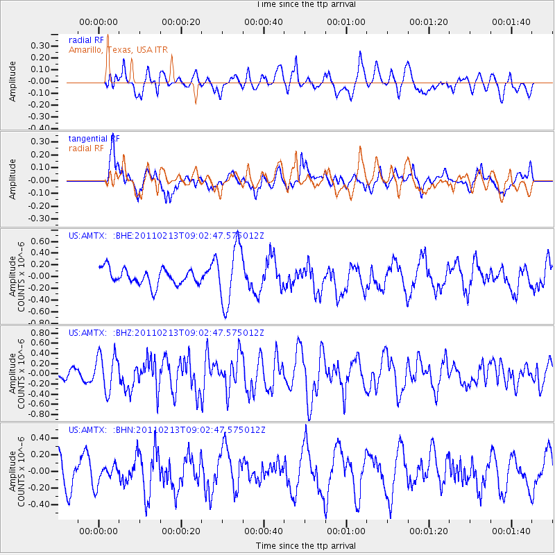
AMTX Amarillo, Texas, USA - Earthquake Result Viewer
*The percent match for this event was below the threshold and hence no stack was calculated.
| Earthquake location: |
Near Coast Of Central Chile |
| Earthquake latitude/longitude: |
-36.6/-73.2 |
| Earthquake time(UTC): |
2011/02/13 (044) 08:51:34 GMT |
| Earthquake Depth: |
21 km |
| Earthquake Magnitude: |
5.7 MS, 5.4 MB, 5.9 MW, 5.8 MW |
| Earthquake Catalog/Contributor: |
WHDF/NEIC |
|
| Network: |
US United States National Seismic Network |
| Station: |
AMTX Amarillo, Texas, USA |
| Lat/Lon: |
34.53 N/101.41 W |
| Elevation: |
1010 m |
|
| Distance: |
75.5 deg |
| Az: |
336.207 deg |
| Baz: |
156.833 deg |
| Ray Param: |
$rayparam |
*The percent match for this event was below the threshold and hence was not used in the summary stack. |
|
| Radial Match: |
49.266354 % |
| Radial Bump: |
400 |
| Transverse Match: |
47.65869 % |
| Transverse Bump: |
400 |
| SOD ConfigId: |
350818 |
| Insert Time: |
2011-07-26 10:00:29.472 +0000 |
| GWidth: |
2.5 |
| Max Bumps: |
400 |
| Tol: |
0.001 |
|
Signal To Noise
| Channel | StoN | STA | LTA |
| US:AMTX: :BHZ:20110213T09:02:47.575012Z | 2.1422114 | 3.671891E-7 | 1.7140657E-7 |
| US:AMTX: :BHN:20110213T09:02:47.575012Z | 0.40371585 | 1.1524842E-7 | 2.8546916E-7 |
| US:AMTX: :BHE:20110213T09:02:47.575012Z | 2.7812328 | 3.8853298E-7 | 1.3969812E-7 |
| Arrivals |
| Ps | |
| PpPs | |
| PsPs/PpSs | |


