You are here: Home > Network List > IW - Intermountain West Stations List
> Station IMW Indian Meadow, Wyoming, USA > Earthquake Result Viewer
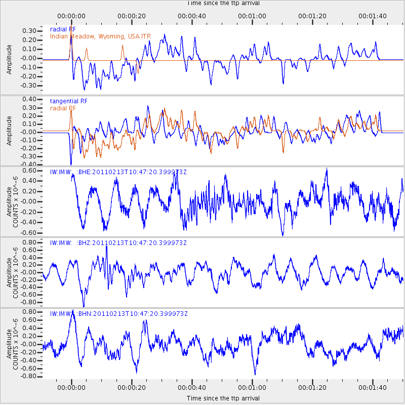
IMW Indian Meadow, Wyoming, USA - Earthquake Result Viewer
*The percent match for this event was below the threshold and hence no stack was calculated.
| Earthquake location: |
Near Coast Of Central Chile |
| Earthquake latitude/longitude: |
-36.6/-73.2 |
| Earthquake time(UTC): |
2011/02/13 (044) 10:35:06 GMT |
| Earthquake Depth: |
17 km |
| Earthquake Magnitude: |
5.6 MB, 5.8 MS, 6.0 MW, 6.0 MW |
| Earthquake Catalog/Contributor: |
WHDF/NEIC |
|
| Network: |
IW Intermountain West |
| Station: |
IMW Indian Meadow, Wyoming, USA |
| Lat/Lon: |
43.90 N/110.94 W |
| Elevation: |
2646 m |
|
| Distance: |
87.2 deg |
| Az: |
333.689 deg |
| Baz: |
150.456 deg |
| Ray Param: |
$rayparam |
*The percent match for this event was below the threshold and hence was not used in the summary stack. |
|
| Radial Match: |
48.834663 % |
| Radial Bump: |
400 |
| Transverse Match: |
48.268867 % |
| Transverse Bump: |
400 |
| SOD ConfigId: |
350818 |
| Insert Time: |
2011-07-26 10:14:38.911 +0000 |
| GWidth: |
2.5 |
| Max Bumps: |
400 |
| Tol: |
0.001 |
|
Signal To Noise
| Channel | StoN | STA | LTA |
| IW:IMW: :BHZ:20110213T10:47:20.399973Z | 1.9038899 | 4.1158384E-7 | 2.161805E-7 |
| IW:IMW: :BHN:20110213T10:47:20.399973Z | 2.9116447 | 4.851355E-7 | 1.6661905E-7 |
| IW:IMW: :BHE:20110213T10:47:20.399973Z | 0.86356235 | 2.3939288E-7 | 2.772155E-7 |
| Arrivals |
| Ps | |
| PpPs | |
| PsPs/PpSs | |


