You are here: Home > Network List > TA - USArray Transportable Network (new EarthScope stations) Stations List
> Station I26A New Underwood, SD, USA > Earthquake Result Viewer
I26A New Underwood, SD, USA - Earthquake Result Viewer
*The percent match for this event was below the threshold and hence no stack was calculated.
| Earthquake location: |
Near Coast Of Central Chile |
| Earthquake latitude/longitude: |
-36.6/-73.2 |
| Earthquake time(UTC): |
2011/02/13 (044) 10:35:06 GMT |
| Earthquake Depth: |
17 km |
| Earthquake Magnitude: |
5.6 MB, 5.8 MS, 6.0 MW, 6.0 MW |
| Earthquake Catalog/Contributor: |
WHDF/NEIC |
|
| Network: |
TA USArray Transportable Network (new EarthScope stations) |
| Station: |
I26A New Underwood, SD, USA |
| Lat/Lon: |
44.03 N/102.86 W |
| Elevation: |
971 m |
|
| Distance: |
84.7 deg |
| Az: |
338.978 deg |
| Baz: |
156.424 deg |
| Ray Param: |
$rayparam |
*The percent match for this event was below the threshold and hence was not used in the summary stack. |
|
| Radial Match: |
44.529232 % |
| Radial Bump: |
328 |
| Transverse Match: |
62.33801 % |
| Transverse Bump: |
391 |
| SOD ConfigId: |
350818 |
| Insert Time: |
2011-07-26 10:33:07.153 +0000 |
| GWidth: |
2.5 |
| Max Bumps: |
400 |
| Tol: |
0.001 |
|
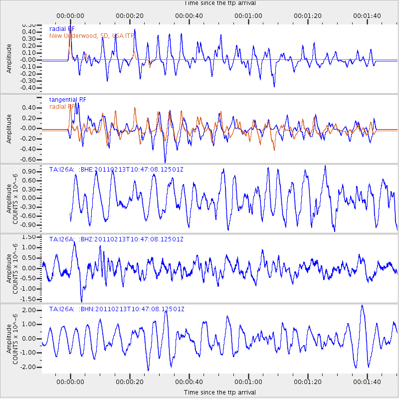
Signal To Noise
| Channel | StoN | STA | LTA |
| TA:I26A: :BHZ:20110213T10:47:08.12501Z | 3.4340413 | 7.976108E-7 | 2.3226595E-7 |
| TA:I26A: :BHN:20110213T10:47:08.12501Z | 1.2131525 | 6.878994E-7 | 5.6703453E-7 |
| TA:I26A: :BHE:20110213T10:47:08.12501Z | 1.0398698 | 4.7805054E-7 | 4.5972152E-7 |
| Arrivals |
| Ps | |
| PpPs | |
| PsPs/PpSs | |


