You are here: Home > Network List > TA - USArray Transportable Network (new EarthScope stations) Stations List
> Station I31A Royce, Wessington Springs, SD, USA > Earthquake Result Viewer
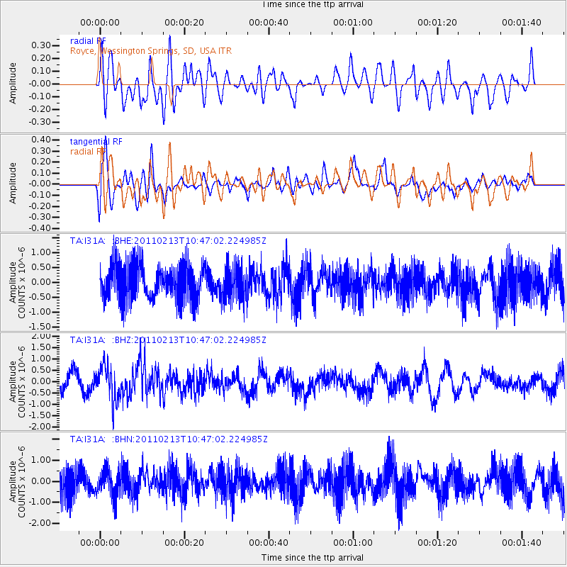
I31A Royce, Wessington Springs, SD, USA - Earthquake Result Viewer
*The percent match for this event was below the threshold and hence no stack was calculated.
| Earthquake location: |
Near Coast Of Central Chile |
| Earthquake latitude/longitude: |
-36.6/-73.2 |
| Earthquake time(UTC): |
2011/02/13 (044) 10:35:06 GMT |
| Earthquake Depth: |
17 km |
| Earthquake Magnitude: |
5.6 MB, 5.8 MS, 6.0 MW, 6.0 MW |
| Earthquake Catalog/Contributor: |
WHDF/NEIC |
|
| Network: |
TA USArray Transportable Network (new EarthScope stations) |
| Station: |
I31A Royce, Wessington Springs, SD, USA |
| Lat/Lon: |
44.03 N/98.54 W |
| Elevation: |
469 m |
|
| Distance: |
83.5 deg |
| Az: |
341.886 deg |
| Baz: |
159.718 deg |
| Ray Param: |
$rayparam |
*The percent match for this event was below the threshold and hence was not used in the summary stack. |
|
| Radial Match: |
58.244385 % |
| Radial Bump: |
400 |
| Transverse Match: |
72.366776 % |
| Transverse Bump: |
400 |
| SOD ConfigId: |
350818 |
| Insert Time: |
2011-07-26 11:46:19.434 +0000 |
| GWidth: |
2.5 |
| Max Bumps: |
400 |
| Tol: |
0.001 |
|
Signal To Noise
| Channel | StoN | STA | LTA |
| TA:I31A: :BHZ:20110213T10:47:02.224985Z | 2.418792 | 7.6083296E-7 | 3.1455082E-7 |
| TA:I31A: :BHN:20110213T10:47:02.224985Z | 1.0576069 | 6.534532E-7 | 6.1786017E-7 |
| TA:I31A: :BHE:20110213T10:47:02.224985Z | 0.9602479 | 5.6651595E-7 | 5.8996847E-7 |
| Arrivals |
| Ps | |
| PpPs | |
| PsPs/PpSs | |


