You are here: Home > Network List > TA - USArray Transportable Network (new EarthScope stations) Stations List
> Station K31A O'Neill, NE, USA > Earthquake Result Viewer
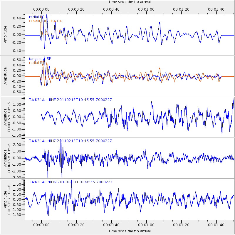
K31A O'Neill, NE, USA - Earthquake Result Viewer
*The percent match for this event was below the threshold and hence no stack was calculated.
| Earthquake location: |
Near Coast Of Central Chile |
| Earthquake latitude/longitude: |
-36.6/-73.2 |
| Earthquake time(UTC): |
2011/02/13 (044) 10:35:06 GMT |
| Earthquake Depth: |
17 km |
| Earthquake Magnitude: |
5.6 MB, 5.8 MS, 6.0 MW, 6.0 MW |
| Earthquake Catalog/Contributor: |
WHDF/NEIC |
|
| Network: |
TA USArray Transportable Network (new EarthScope stations) |
| Station: |
K31A O'Neill, NE, USA |
| Lat/Lon: |
42.62 N/98.75 W |
| Elevation: |
580 m |
|
| Distance: |
82.3 deg |
| Az: |
341.241 deg |
| Baz: |
159.488 deg |
| Ray Param: |
$rayparam |
*The percent match for this event was below the threshold and hence was not used in the summary stack. |
|
| Radial Match: |
55.404125 % |
| Radial Bump: |
400 |
| Transverse Match: |
61.4688 % |
| Transverse Bump: |
400 |
| SOD ConfigId: |
350818 |
| Insert Time: |
2011-07-26 11:55:59.189 +0000 |
| GWidth: |
2.5 |
| Max Bumps: |
400 |
| Tol: |
0.001 |
|
Signal To Noise
| Channel | StoN | STA | LTA |
| TA:K31A: :BHZ:20110213T10:46:55.700022Z | 3.439253 | 8.538631E-7 | 2.4826994E-7 |
| TA:K31A: :BHN:20110213T10:46:55.700022Z | 1.7824554 | 6.2323335E-7 | 3.496488E-7 |
| TA:K31A: :BHE:20110213T10:46:55.700022Z | 0.9547409 | 2.9274713E-7 | 3.0662468E-7 |
| Arrivals |
| Ps | |
| PpPs | |
| PsPs/PpSs | |


