You are here: Home > Network List > TA - USArray Transportable Network (new EarthScope stations) Stations List
> Station G32A Webster, SD, USA > Earthquake Result Viewer
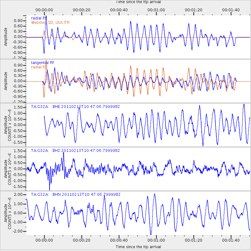
G32A Webster, SD, USA - Earthquake Result Viewer
*The percent match for this event was below the threshold and hence no stack was calculated.
| Earthquake location: |
Near Coast Of Central Chile |
| Earthquake latitude/longitude: |
-36.6/-73.2 |
| Earthquake time(UTC): |
2011/02/13 (044) 10:35:06 GMT |
| Earthquake Depth: |
17 km |
| Earthquake Magnitude: |
5.6 MB, 5.8 MS, 6.0 MW, 6.0 MW |
| Earthquake Catalog/Contributor: |
WHDF/NEIC |
|
| Network: |
TA USArray Transportable Network (new EarthScope stations) |
| Station: |
G32A Webster, SD, USA |
| Lat/Lon: |
45.26 N/97.50 W |
| Elevation: |
566 m |
|
| Distance: |
84.4 deg |
| Az: |
343.004 deg |
| Baz: |
160.56 deg |
| Ray Param: |
$rayparam |
*The percent match for this event was below the threshold and hence was not used in the summary stack. |
|
| Radial Match: |
59.00249 % |
| Radial Bump: |
400 |
| Transverse Match: |
65.85058 % |
| Transverse Bump: |
400 |
| SOD ConfigId: |
350818 |
| Insert Time: |
2011-07-26 11:59:11.443 +0000 |
| GWidth: |
2.5 |
| Max Bumps: |
400 |
| Tol: |
0.001 |
|
Signal To Noise
| Channel | StoN | STA | LTA |
| TA:G32A: :BHZ:20110213T10:47:06.799998Z | 2.5098495 | 5.8843443E-7 | 2.3445008E-7 |
| TA:G32A: :BHN:20110213T10:47:06.799998Z | 1.2216816 | 7.3072414E-7 | 5.981298E-7 |
| TA:G32A: :BHE:20110213T10:47:06.799998Z | 0.7872681 | 4.6636185E-7 | 5.9238E-7 |
| Arrivals |
| Ps | |
| PpPs | |
| PsPs/PpSs | |


