You are here: Home > Network List > US - United States National Seismic Network Stations List
> Station LKWY Lake (Yellowstone--Lake), Wyoming, USA > Earthquake Result Viewer
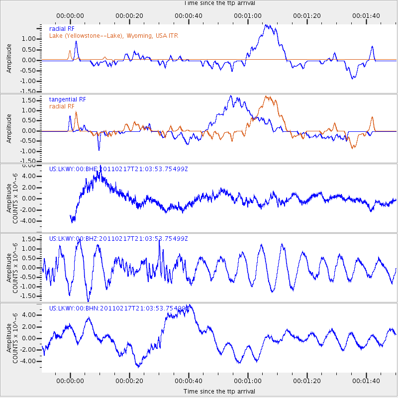
LKWY Lake (Yellowstone--Lake), Wyoming, USA - Earthquake Result Viewer
*The percent match for this event was below the threshold and hence no stack was calculated.
| Earthquake location: |
Vanuatu Islands |
| Earthquake latitude/longitude: |
-14.2/166.5 |
| Earthquake time(UTC): |
2011/02/17 (048) 20:51:04 GMT |
| Earthquake Depth: |
22 km |
| Earthquake Magnitude: |
5.5 MB, 5.3 MS, 5.6 MW, 5.6 MW |
| Earthquake Catalog/Contributor: |
WHDF/NEIC |
|
| Network: |
US United States National Seismic Network |
| Station: |
LKWY Lake (Yellowstone--Lake), Wyoming, USA |
| Lat/Lon: |
44.57 N/110.40 W |
| Elevation: |
2424 m |
|
| Distance: |
95.0 deg |
| Az: |
45.429 deg |
| Baz: |
255.17 deg |
| Ray Param: |
$rayparam |
*The percent match for this event was below the threshold and hence was not used in the summary stack. |
|
| Radial Match: |
44.281986 % |
| Radial Bump: |
400 |
| Transverse Match: |
24.940126 % |
| Transverse Bump: |
400 |
| SOD ConfigId: |
350818 |
| Insert Time: |
2011-07-26 13:12:32.052 +0000 |
| GWidth: |
2.5 |
| Max Bumps: |
400 |
| Tol: |
0.001 |
|
Signal To Noise
| Channel | StoN | STA | LTA |
| US:LKWY:00:BHZ:20110217T21:03:53.75499Z | 2.309945 | 9.986423E-7 | 4.32323E-7 |
| US:LKWY:00:BHN:20110217T21:03:53.75499Z | 2.3209808 | 2.4993371E-6 | 1.0768453E-6 |
| US:LKWY:00:BHE:20110217T21:03:53.75499Z | 1.1627336 | 2.4858957E-6 | 2.1379753E-6 |
| Arrivals |
| Ps | |
| PpPs | |
| PsPs/PpSs | |


