You are here: Home > Network List > CI - Caltech Regional Seismic Network Stations List
> Station SMM Simmler, CA, USA > Earthquake Result Viewer
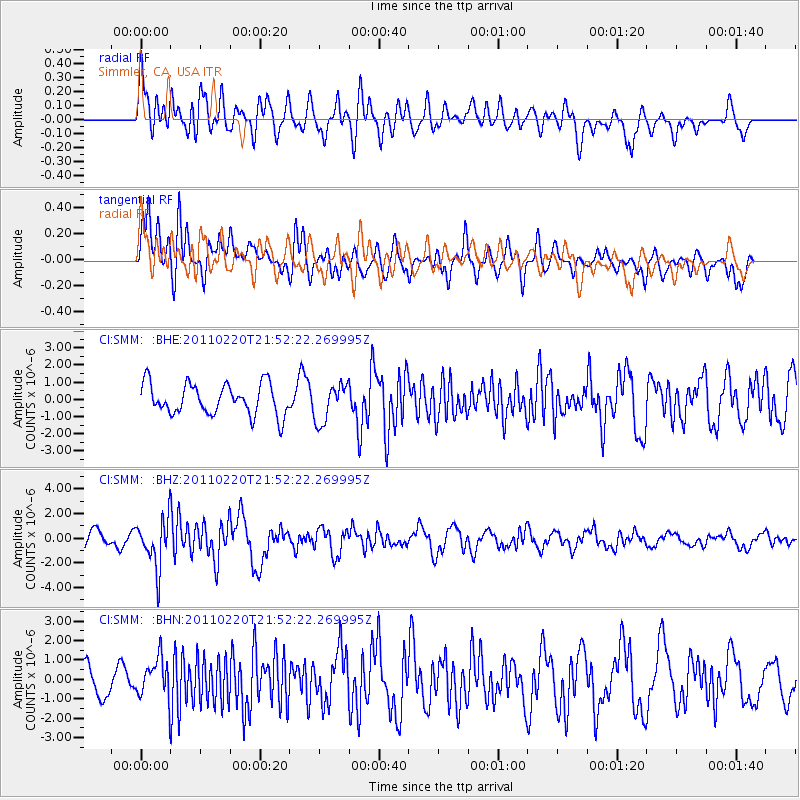
SMM Simmler, CA, USA - Earthquake Result Viewer
*The percent match for this event was below the threshold and hence no stack was calculated.
| Earthquake location: |
Near East Coast Of Kamchatka |
| Earthquake latitude/longitude: |
55.9/162.1 |
| Earthquake time(UTC): |
2011/02/20 (051) 21:43:24 GMT |
| Earthquake Depth: |
33 km |
| Earthquake Magnitude: |
6.1 MB, 5.9 MS, 6.2 MW, 5.9 MW |
| Earthquake Catalog/Contributor: |
WHDF/NEIC |
|
| Network: |
CI Caltech Regional Seismic Network |
| Station: |
SMM Simmler, CA, USA |
| Lat/Lon: |
35.31 N/120.00 W |
| Elevation: |
599 m |
|
| Distance: |
55.1 deg |
| Az: |
77.168 deg |
| Baz: |
317.842 deg |
| Ray Param: |
$rayparam |
*The percent match for this event was below the threshold and hence was not used in the summary stack. |
|
| Radial Match: |
64.346855 % |
| Radial Bump: |
400 |
| Transverse Match: |
76.764275 % |
| Transverse Bump: |
400 |
| SOD ConfigId: |
353373 |
| Insert Time: |
2011-07-30 07:35:03.640 +0000 |
| GWidth: |
2.5 |
| Max Bumps: |
400 |
| Tol: |
0.001 |
|
Signal To Noise
| Channel | StoN | STA | LTA |
| CI:SMM: :BHZ:20110220T21:52:22.269995Z | 2.8800652 | 1.974646E-6 | 6.856254E-7 |
| CI:SMM: :BHN:20110220T21:52:22.269995Z | 1.1347268 | 1.0479148E-6 | 9.2349524E-7 |
| CI:SMM: :BHE:20110220T21:52:22.269995Z | 1.2361629 | 1.106272E-6 | 8.949241E-7 |
| Arrivals |
| Ps | |
| PpPs | |
| PsPs/PpSs | |


