You are here: Home > Network List > IU - Global Seismograph Network (GSN - IRIS/USGS) Stations List
> Station GRFO Grafenberg, Germany > Earthquake Result Viewer
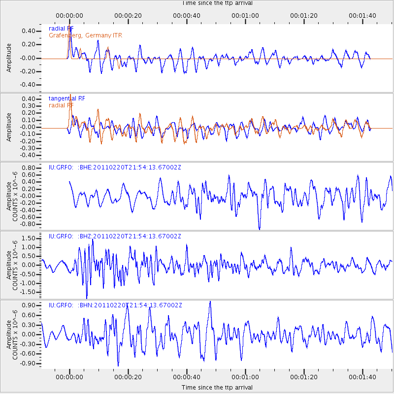
GRFO Grafenberg, Germany - Earthquake Result Viewer
*The percent match for this event was below the threshold and hence no stack was calculated.
| Earthquake location: |
Near East Coast Of Kamchatka |
| Earthquake latitude/longitude: |
55.9/162.1 |
| Earthquake time(UTC): |
2011/02/20 (051) 21:43:24 GMT |
| Earthquake Depth: |
33 km |
| Earthquake Magnitude: |
6.1 MB, 5.9 MS, 6.2 MW, 5.9 MW |
| Earthquake Catalog/Contributor: |
WHDF/NEIC |
|
| Network: |
IU Global Seismograph Network (GSN - IRIS/USGS) |
| Station: |
GRFO Grafenberg, Germany |
| Lat/Lon: |
49.69 N/11.22 E |
| Elevation: |
384 m |
|
| Distance: |
72.0 deg |
| Az: |
340.602 deg |
| Baz: |
16.733 deg |
| Ray Param: |
$rayparam |
*The percent match for this event was below the threshold and hence was not used in the summary stack. |
|
| Radial Match: |
57.804176 % |
| Radial Bump: |
400 |
| Transverse Match: |
51.909687 % |
| Transverse Bump: |
400 |
| SOD ConfigId: |
353373 |
| Insert Time: |
2011-07-30 07:53:02.561 +0000 |
| GWidth: |
2.5 |
| Max Bumps: |
400 |
| Tol: |
0.001 |
|
Signal To Noise
| Channel | StoN | STA | LTA |
| IU:GRFO: :BHZ:20110220T21:54:13.67002Z | 2.5272489 | 4.6938416E-7 | 1.857293E-7 |
| IU:GRFO: :BHN:20110220T21:54:13.67002Z | 0.7609829 | 1.6259358E-7 | 2.1366259E-7 |
| IU:GRFO: :BHE:20110220T21:54:13.67002Z | 1.4161453 | 2.546738E-7 | 1.7983592E-7 |
| Arrivals |
| Ps | |
| PpPs | |
| PsPs/PpSs | |


