You are here: Home > Network List > TA - USArray Transportable Network (new EarthScope stations) Stations List
> Station U33A Lingo Farm, Meno, OK, USA > Earthquake Result Viewer
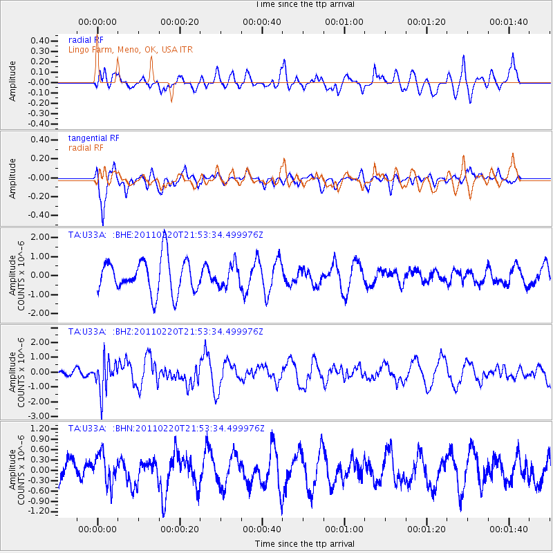
U33A Lingo Farm, Meno, OK, USA - Earthquake Result Viewer
*The percent match for this event was below the threshold and hence no stack was calculated.
| Earthquake location: |
Near East Coast Of Kamchatka |
| Earthquake latitude/longitude: |
55.9/162.1 |
| Earthquake time(UTC): |
2011/02/20 (051) 21:43:24 GMT |
| Earthquake Depth: |
33 km |
| Earthquake Magnitude: |
6.1 MB, 5.9 MS, 6.2 MW, 5.9 MW |
| Earthquake Catalog/Contributor: |
WHDF/NEIC |
|
| Network: |
TA USArray Transportable Network (new EarthScope stations) |
| Station: |
U33A Lingo Farm, Meno, OK, USA |
| Lat/Lon: |
36.43 N/98.11 W |
| Elevation: |
393 m |
|
| Distance: |
65.7 deg |
| Az: |
60.701 deg |
| Baz: |
322.499 deg |
| Ray Param: |
$rayparam |
*The percent match for this event was below the threshold and hence was not used in the summary stack. |
|
| Radial Match: |
49.466743 % |
| Radial Bump: |
400 |
| Transverse Match: |
76.755035 % |
| Transverse Bump: |
400 |
| SOD ConfigId: |
353373 |
| Insert Time: |
2011-07-30 09:19:08.012 +0000 |
| GWidth: |
2.5 |
| Max Bumps: |
400 |
| Tol: |
0.001 |
|
Signal To Noise
| Channel | StoN | STA | LTA |
| TA:U33A: :BHZ:20110220T21:53:34.499976Z | 3.0873382 | 1.0895988E-6 | 3.5292496E-7 |
| TA:U33A: :BHN:20110220T21:53:34.499976Z | 1.1107048 | 4.5111793E-7 | 4.061547E-7 |
| TA:U33A: :BHE:20110220T21:53:34.499976Z | 0.659425 | 5.9846917E-7 | 9.0756214E-7 |
| Arrivals |
| Ps | |
| PpPs | |
| PsPs/PpSs | |


