You are here: Home > Network List > TA - USArray Transportable Network (new EarthScope stations) Stations List
> Station X35A Drake, OK, USA > Earthquake Result Viewer
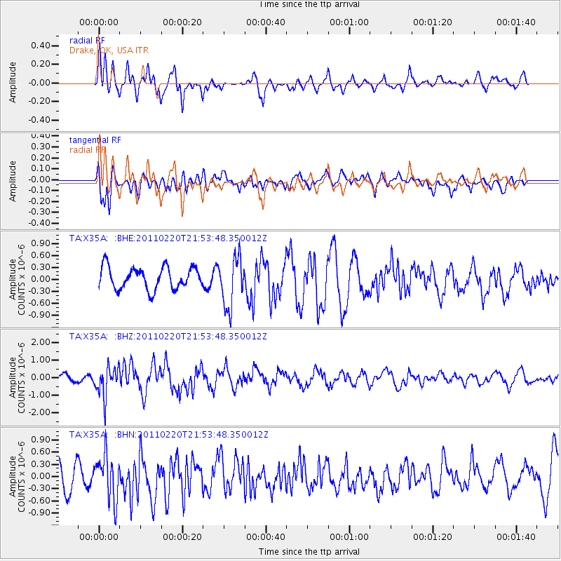
X35A Drake, OK, USA - Earthquake Result Viewer
*The percent match for this event was below the threshold and hence no stack was calculated.
| Earthquake location: |
Near East Coast Of Kamchatka |
| Earthquake latitude/longitude: |
55.9/162.1 |
| Earthquake time(UTC): |
2011/02/20 (051) 21:43:24 GMT |
| Earthquake Depth: |
33 km |
| Earthquake Magnitude: |
6.1 MB, 5.9 MS, 6.2 MW, 5.9 MW |
| Earthquake Catalog/Contributor: |
WHDF/NEIC |
|
| Network: |
TA USArray Transportable Network (new EarthScope stations) |
| Station: |
X35A Drake, OK, USA |
| Lat/Lon: |
34.40 N/96.97 W |
| Elevation: |
300 m |
|
| Distance: |
67.9 deg |
| Az: |
61.223 deg |
| Baz: |
323.363 deg |
| Ray Param: |
$rayparam |
*The percent match for this event was below the threshold and hence was not used in the summary stack. |
|
| Radial Match: |
63.084015 % |
| Radial Bump: |
400 |
| Transverse Match: |
50.758854 % |
| Transverse Bump: |
400 |
| SOD ConfigId: |
353373 |
| Insert Time: |
2011-07-30 09:57:34.326 +0000 |
| GWidth: |
2.5 |
| Max Bumps: |
400 |
| Tol: |
0.001 |
|
Signal To Noise
| Channel | StoN | STA | LTA |
| TA:X35A: :BHZ:20110220T21:53:48.350012Z | 2.5030246 | 8.546139E-7 | 3.414325E-7 |
| TA:X35A: :BHN:20110220T21:53:48.350012Z | 1.7764966 | 5.5541364E-7 | 3.1264548E-7 |
| TA:X35A: :BHE:20110220T21:53:48.350012Z | 2.3356597 | 6.307116E-7 | 2.7003574E-7 |
| Arrivals |
| Ps | |
| PpPs | |
| PsPs/PpSs | |


