You are here: Home > Network List > US - United States National Seismic Network Stations List
> Station WUAZ Wupatki, Arizona, USA > Earthquake Result Viewer
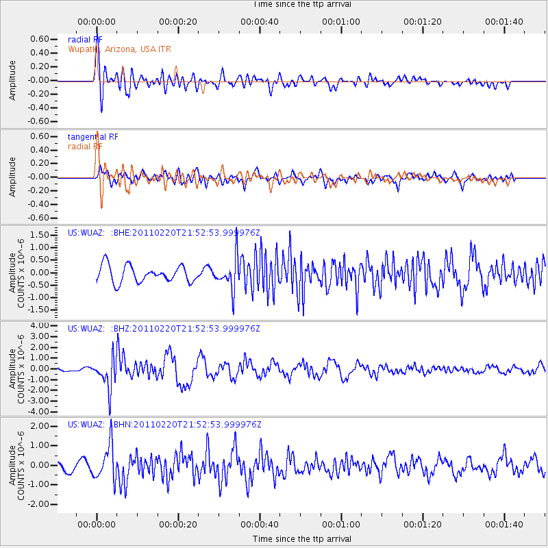
WUAZ Wupatki, Arizona, USA - Earthquake Result Viewer
*The percent match for this event was below the threshold and hence no stack was calculated.
| Earthquake location: |
Near East Coast Of Kamchatka |
| Earthquake latitude/longitude: |
55.9/162.1 |
| Earthquake time(UTC): |
2011/02/20 (051) 21:43:24 GMT |
| Earthquake Depth: |
33 km |
| Earthquake Magnitude: |
6.1 MB, 5.9 MS, 6.2 MW, 5.9 MW |
| Earthquake Catalog/Contributor: |
WHDF/NEIC |
|
| Network: |
US United States National Seismic Network |
| Station: |
WUAZ Wupatki, Arizona, USA |
| Lat/Lon: |
35.52 N/111.37 W |
| Elevation: |
1592 m |
|
| Distance: |
59.6 deg |
| Az: |
70.738 deg |
| Baz: |
319.348 deg |
| Ray Param: |
$rayparam |
*The percent match for this event was below the threshold and hence was not used in the summary stack. |
|
| Radial Match: |
77.37807 % |
| Radial Bump: |
400 |
| Transverse Match: |
56.99078 % |
| Transverse Bump: |
400 |
| SOD ConfigId: |
353373 |
| Insert Time: |
2011-07-30 11:50:10.821 +0000 |
| GWidth: |
2.5 |
| Max Bumps: |
400 |
| Tol: |
0.001 |
|
Signal To Noise
| Channel | StoN | STA | LTA |
| US:WUAZ: :BHZ:20110220T21:52:53.999976Z | 7.9680448 | 1.4194344E-6 | 1.7814087E-7 |
| US:WUAZ: :BHN:20110220T21:52:53.999976Z | 2.361033 | 9.18537E-7 | 3.8904034E-7 |
| US:WUAZ: :BHE:20110220T21:52:53.999976Z | 1.9959809 | 6.592356E-7 | 3.3028152E-7 |
| Arrivals |
| Ps | |
| PpPs | |
| PsPs/PpSs | |


