You are here: Home > Network List > UW - Pacific Northwest Regional Seismic Network Stations List
> Station LEBA Lebam, WA, USA > Earthquake Result Viewer
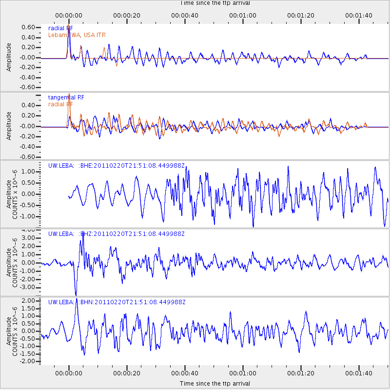
LEBA Lebam, WA, USA - Earthquake Result Viewer
*The percent match for this event was below the threshold and hence no stack was calculated.
| Earthquake location: |
Near East Coast Of Kamchatka |
| Earthquake latitude/longitude: |
55.9/162.1 |
| Earthquake time(UTC): |
2011/02/20 (051) 21:43:24 GMT |
| Earthquake Depth: |
33 km |
| Earthquake Magnitude: |
6.1 MB, 5.9 MS, 6.2 MW, 5.9 MW |
| Earthquake Catalog/Contributor: |
WHDF/NEIC |
|
| Network: |
UW Pacific Northwest Regional Seismic Network |
| Station: |
LEBA Lebam, WA, USA |
| Lat/Lon: |
46.55 N/123.56 W |
| Elevation: |
73 m |
|
| Distance: |
45.3 deg |
| Az: |
69.142 deg |
| Baz: |
310.342 deg |
| Ray Param: |
$rayparam |
*The percent match for this event was below the threshold and hence was not used in the summary stack. |
|
| Radial Match: |
74.060165 % |
| Radial Bump: |
400 |
| Transverse Match: |
67.78656 % |
| Transverse Bump: |
400 |
| SOD ConfigId: |
353373 |
| Insert Time: |
2011-07-30 12:31:12.058 +0000 |
| GWidth: |
2.5 |
| Max Bumps: |
400 |
| Tol: |
0.001 |
|
Signal To Noise
| Channel | StoN | STA | LTA |
| UW:LEBA: :BHZ:20110220T21:51:08.449988Z | 6.234035 | 1.660332E-6 | 2.6633344E-7 |
| UW:LEBA: :BHN:20110220T21:51:08.449988Z | 3.2518055 | 9.3979577E-7 | 2.8900735E-7 |
| UW:LEBA: :BHE:20110220T21:51:08.449988Z | 1.5906013 | 5.404771E-7 | 3.3979418E-7 |
| Arrivals |
| Ps | |
| PpPs | |
| PsPs/PpSs | |


