You are here: Home > Network List > TA - USArray Transportable Network (new EarthScope stations) Stations List
> Station MDND Maddock, ND, USA > Earthquake Result Viewer
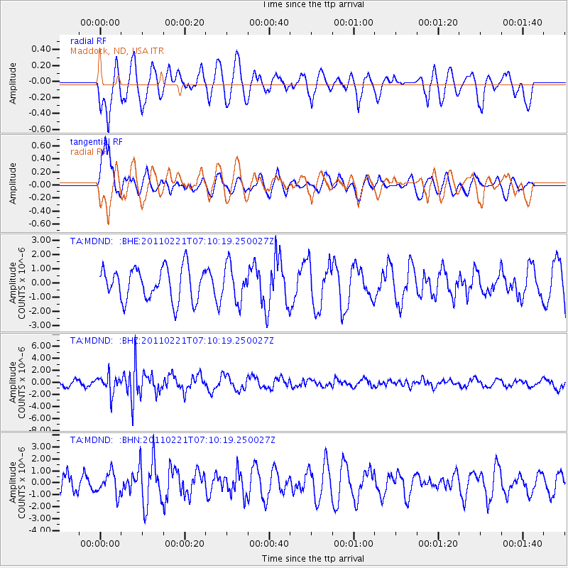
MDND Maddock, ND, USA - Earthquake Result Viewer
*The percent match for this event was below the threshold and hence no stack was calculated.
| Earthquake location: |
Santiago Del Estero Prov., Arg. |
| Earthquake latitude/longitude: |
-27.1/-64.7 |
| Earthquake time(UTC): |
2011/02/21 (052) 06:58:36 GMT |
| Earthquake Depth: |
13 km |
| Earthquake Magnitude: |
6.0 MB, 5.4 MS, 5.6 MW, 5.5 MW |
| Earthquake Catalog/Contributor: |
WHDF/NEIC |
|
| Network: |
TA USArray Transportable Network (new EarthScope stations) |
| Station: |
MDND Maddock, ND, USA |
| Lat/Lon: |
47.85 N/99.60 W |
| Elevation: |
479 m |
|
| Distance: |
81.0 deg |
| Az: |
337.024 deg |
| Baz: |
148.91 deg |
| Ray Param: |
$rayparam |
*The percent match for this event was below the threshold and hence was not used in the summary stack. |
|
| Radial Match: |
53.632496 % |
| Radial Bump: |
400 |
| Transverse Match: |
83.742165 % |
| Transverse Bump: |
400 |
| SOD ConfigId: |
353373 |
| Insert Time: |
2011-07-30 13:05:11.554 +0000 |
| GWidth: |
2.5 |
| Max Bumps: |
400 |
| Tol: |
0.001 |
|
Signal To Noise
| Channel | StoN | STA | LTA |
| TA:MDND: :BHZ:20110221T07:10:19.250027Z | 3.1837592 | 1.5187403E-6 | 4.770274E-7 |
| TA:MDND: :BHN:20110221T07:10:19.250027Z | 0.74230105 | 9.2765544E-7 | 1.2497024E-6 |
| TA:MDND: :BHE:20110221T07:10:19.250027Z | 1.1067065 | 1.270651E-6 | 1.1481372E-6 |
| Arrivals |
| Ps | |
| PpPs | |
| PsPs/PpSs | |


