You are here: Home > Network List > GS - US Geological Survey Networks Stations List
> Station DEC12 Boyd Road Surface Site > Earthquake Result Viewer
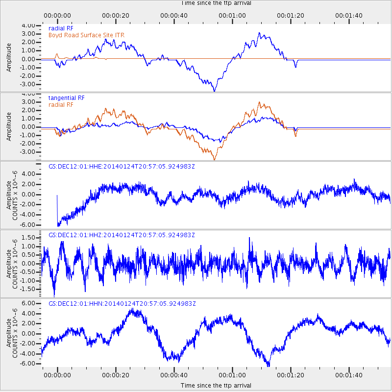
DEC12 Boyd Road Surface Site - Earthquake Result Viewer
*The percent match for this event was below the threshold and hence no stack was calculated.
| Earthquake location: |
Kuril Islands |
| Earthquake latitude/longitude: |
48.7/155.3 |
| Earthquake time(UTC): |
2014/01/24 (024) 20:46:01 GMT |
| Earthquake Depth: |
64 km |
| Earthquake Magnitude: |
4.2 mb |
| Earthquake Catalog/Contributor: |
ISC/ISC |
|
| Network: |
GS US Geological Survey Networks |
| Station: |
DEC12 Boyd Road Surface Site |
| Lat/Lon: |
39.91 N/88.91 W |
| Elevation: |
208 m |
|
| Distance: |
75.1 deg |
| Az: |
45.796 deg |
| Baz: |
321.914 deg |
| Ray Param: |
$rayparam |
*The percent match for this event was below the threshold and hence was not used in the summary stack. |
|
| Radial Match: |
32.021023 % |
| Radial Bump: |
400 |
| Transverse Match: |
41.280018 % |
| Transverse Bump: |
400 |
| SOD ConfigId: |
3390531 |
| Insert Time: |
2019-04-10 02:27:03.128 +0000 |
| GWidth: |
2.5 |
| Max Bumps: |
400 |
| Tol: |
0.001 |
|
Signal To Noise
| Channel | StoN | STA | LTA |
| GS:DEC12:01:HHZ:20140124T20:57:05.924983Z | 1.45558 | 7.706884E-7 | 5.294717E-7 |
| GS:DEC12:01:HHN:20140124T20:57:05.924983Z | 0.58451277 | 3.0146405E-6 | 5.157527E-6 |
| GS:DEC12:01:HHE:20140124T20:57:05.924983Z | 0.7293073 | 1.865026E-6 | 2.5572567E-6 |
| Arrivals |
| Ps | |
| PpPs | |
| PsPs/PpSs | |


