KNW AZ.KNW - Earthquake Result Viewer
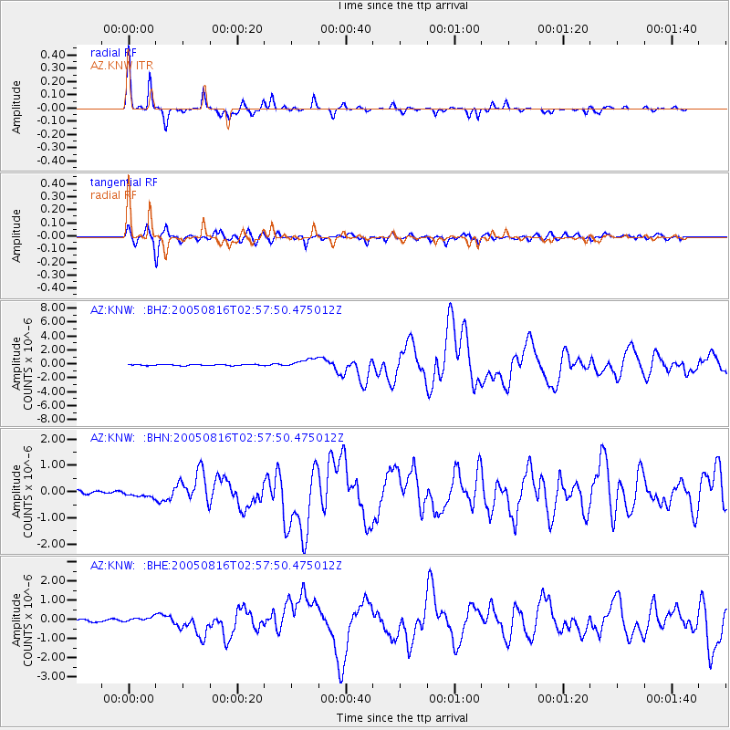
Earthquake location: Near East Coast Of Honshu, Japan
Earthquake latitude/longitude: 38.3/142.0
Earthquake time(UTC): 2005/08/16 (228) 02:46:28 GMT
Earthquake Depth: 36 km
Earthquake Magnitude: 6.5 MB, 6.8 MS, 7.2 MW, 7.1 MW
Earthquake Catalog/Contributor: WHDF/NEIC
Network: AZ ANZA Regional Network
Station: KNW AZ.KNW
Lat/Lon: 33.71 N/116.71 W
Elevation: 1507 m
Distance: 77.7 deg
Az: 56.792 deg
Baz: 307.811 deg
Ray Param: 0.05008304
Estimated Moho Depth: 32.5 km
Estimated Crust Vp/Vs: 1.73
Assumed Crust Vp: 6.264 km/s
Estimated Crust Vs: 3.631 km/s
Estimated Crust Poisson's Ratio: 0.25
Radial Match: 96.596794 %
Radial Bump: 235
Transverse Match: 92.30919 %
Transverse Bump: 400
SOD ConfigId: 2475
Insert Time: 2010-02-26 19:31:11.187 +0000
GWidth: 2.5
Max Bumps: 400
Tol: 0.001

Signal To Noise

ChannelStoNSTALTA
AZ:KNW: :BHN:20050816T02:57:50.475012Z1.63703621.1872317E-77.252324E-8
AZ:KNW: :BHE:20050816T02:57:50.475012Z2.16424781.5001645E-76.931574E-8
AZ:KNW: :BHZ:20050816T02:57:50.475012Z7.68756636.3916775E-78.314306E-8
Arrivals
Ps3.9 SECOND
PpPs14 SECOND
PsPs/PpSs18 SECOND