You are here: Home > Network List > US - United States National Seismic Network Stations List
> Station ERPA Erie, Pennsylvania, USA > Earthquake Result Viewer
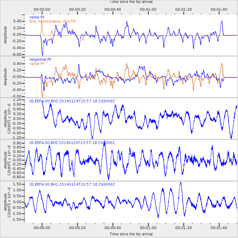
ERPA Erie, Pennsylvania, USA - Earthquake Result Viewer
*The percent match for this event was below the threshold and hence no stack was calculated.
| Earthquake location: |
Kuril Islands |
| Earthquake latitude/longitude: |
48.7/155.3 |
| Earthquake time(UTC): |
2014/01/24 (024) 20:46:01 GMT |
| Earthquake Depth: |
64 km |
| Earthquake Magnitude: |
4.2 mb |
| Earthquake Catalog/Contributor: |
ISC/ISC |
|
| Network: |
US United States National Seismic Network |
| Station: |
ERPA Erie, Pennsylvania, USA |
| Lat/Lon: |
42.12 N/79.99 W |
| Elevation: |
306 m |
|
| Distance: |
77.3 deg |
| Az: |
38.842 deg |
| Baz: |
326.086 deg |
| Ray Param: |
$rayparam |
*The percent match for this event was below the threshold and hence was not used in the summary stack. |
|
| Radial Match: |
51.6921 % |
| Radial Bump: |
400 |
| Transverse Match: |
48.514343 % |
| Transverse Bump: |
400 |
| SOD ConfigId: |
3390531 |
| Insert Time: |
2019-04-10 02:31:02.003 +0000 |
| GWidth: |
2.5 |
| Max Bumps: |
400 |
| Tol: |
0.001 |
|
Signal To Noise
| Channel | StoN | STA | LTA |
| US:ERPA:00:BHZ:20140124T20:57:18.299006Z | 1.3737632 | 4.3727934E-7 | 3.1830766E-7 |
| US:ERPA:00:BH1:20140124T20:57:18.299006Z | 1.9176216 | 5.418183E-7 | 2.8254703E-7 |
| US:ERPA:00:BH2:20140124T20:57:18.299006Z | 1.2921945 | 5.0588426E-7 | 3.9149234E-7 |
| Arrivals |
| Ps | |
| PpPs | |
| PsPs/PpSs | |


