You are here: Home > Network List > TA - USArray Transportable Network (new EarthScope stations) Stations List
> Station D35A Remer, MN, USA > Earthquake Result Viewer
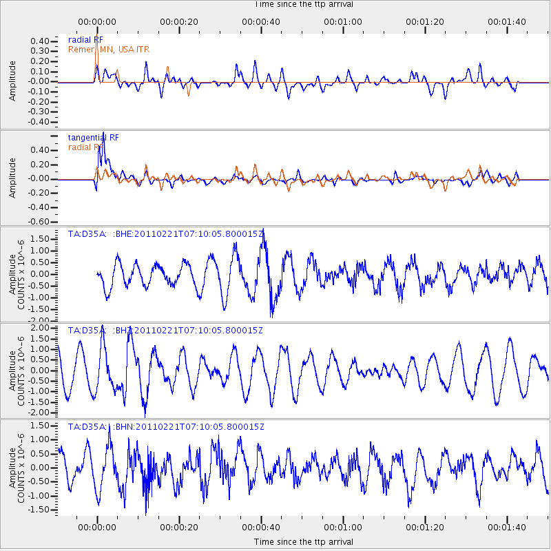
D35A Remer, MN, USA - Earthquake Result Viewer
*The percent match for this event was below the threshold and hence no stack was calculated.
| Earthquake location: |
Santiago Del Estero Prov., Arg. |
| Earthquake latitude/longitude: |
-27.1/-64.7 |
| Earthquake time(UTC): |
2011/02/21 (052) 06:58:36 GMT |
| Earthquake Depth: |
13 km |
| Earthquake Magnitude: |
6.0 MB, 5.4 MS, 5.6 MW, 5.5 MW |
| Earthquake Catalog/Contributor: |
WHDF/NEIC |
|
| Network: |
TA USArray Transportable Network (new EarthScope stations) |
| Station: |
D35A Remer, MN, USA |
| Lat/Lon: |
47.08 N/94.05 W |
| Elevation: |
427 m |
|
| Distance: |
78.5 deg |
| Az: |
340.002 deg |
| Baz: |
153.519 deg |
| Ray Param: |
$rayparam |
*The percent match for this event was below the threshold and hence was not used in the summary stack. |
|
| Radial Match: |
46.419804 % |
| Radial Bump: |
400 |
| Transverse Match: |
83.4903 % |
| Transverse Bump: |
400 |
| SOD ConfigId: |
353373 |
| Insert Time: |
2011-07-30 14:51:21.660 +0000 |
| GWidth: |
2.5 |
| Max Bumps: |
400 |
| Tol: |
0.001 |
|
Signal To Noise
| Channel | StoN | STA | LTA |
| TA:D35A: :BHZ:20110221T07:10:05.800015Z | 1.8432598 | 1.0406402E-6 | 5.6456514E-7 |
| TA:D35A: :BHN:20110221T07:10:05.800015Z | 2.2859242 | 7.6724484E-7 | 3.3563876E-7 |
| TA:D35A: :BHE:20110221T07:10:05.800015Z | 1.941138 | 8.8044123E-7 | 4.5356964E-7 |
| Arrivals |
| Ps | |
| PpPs | |
| PsPs/PpSs | |


