You are here: Home > Network List > CI - Caltech Regional Seismic Network Stations List
> Station BEL Belle Mtn, Joshua Tree National Park, CA, USA > Earthquake Result Viewer
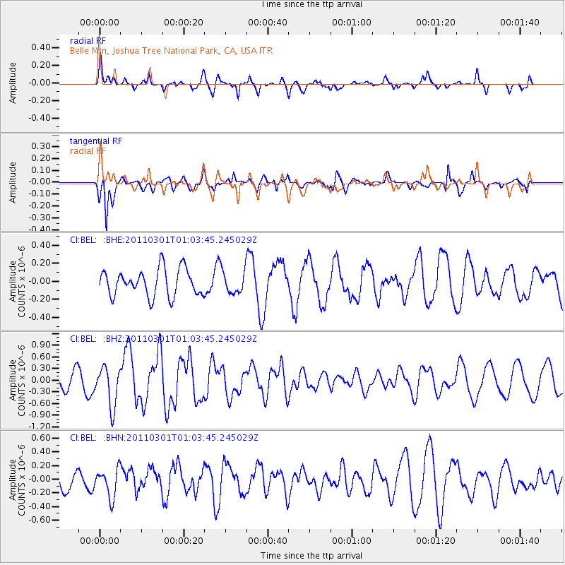
BEL Belle Mtn, Joshua Tree National Park, CA, USA - Earthquake Result Viewer
*The percent match for this event was below the threshold and hence no stack was calculated.
| Earthquake location: |
Easter Island Region |
| Earthquake latitude/longitude: |
-29.7/-112.0 |
| Earthquake time(UTC): |
2011/03/01 (060) 00:53:46 GMT |
| Earthquake Depth: |
10 km |
| Earthquake Magnitude: |
5.6 MB, 6.0 MS, 6.1 MW, 6.0 MW |
| Earthquake Catalog/Contributor: |
WHDF/NEIC |
|
| Network: |
CI Caltech Regional Seismic Network |
| Station: |
BEL Belle Mtn, Joshua Tree National Park, CA, USA |
| Lat/Lon: |
34.00 N/116.00 W |
| Elevation: |
1388 m |
|
| Distance: |
63.5 deg |
| Az: |
356.27 deg |
| Baz: |
176.094 deg |
| Ray Param: |
$rayparam |
*The percent match for this event was below the threshold and hence was not used in the summary stack. |
|
| Radial Match: |
53.520786 % |
| Radial Bump: |
400 |
| Transverse Match: |
67.12565 % |
| Transverse Bump: |
389 |
| SOD ConfigId: |
353373 |
| Insert Time: |
2011-08-01 07:41:16.640 +0000 |
| GWidth: |
2.5 |
| Max Bumps: |
400 |
| Tol: |
0.001 |
|
Signal To Noise
| Channel | StoN | STA | LTA |
| CI:BEL: :BHZ:20110301T01:03:45.245029Z | 2.6397338 | 5.206327E-7 | 1.9722926E-7 |
| CI:BEL: :BHN:20110301T01:03:45.245029Z | 0.8485819 | 2.1682489E-7 | 2.5551438E-7 |
| CI:BEL: :BHE:20110301T01:03:45.245029Z | 0.79852605 | 1.1934961E-7 | 1.4946238E-7 |
| Arrivals |
| Ps | |
| PpPs | |
| PsPs/PpSs | |


