KNW AZ.KNW - Earthquake Result Viewer
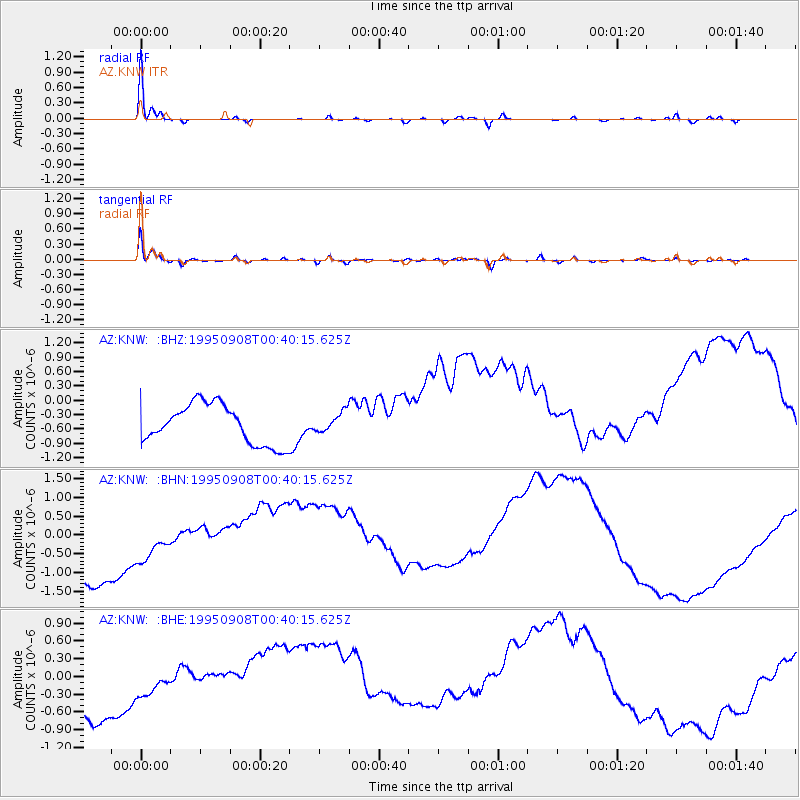
Earthquake location: Southern East Pacific Rise
Earthquake latitude/longitude: -56.2/-122.3
Earthquake time(UTC): 1995/09/08 (251) 00:27:49 GMT
Earthquake Depth: 10 km
Earthquake Magnitude: 4.8 MB, 5.7 MS, 5.8 UNKNOWN
Earthquake Catalog/Contributor: WHDF/NEIC
Network: AZ ANZA Regional Network
Station: KNW AZ.KNW
Lat/Lon: 33.71 N/116.71 W
Elevation: 1507 m
Distance: 89.7 deg
Az: 4.643 deg
Baz: 183.11 deg
Ray Param: 0.041726105
Estimated Moho Depth: 12.5 km
Estimated Crust Vp/Vs: 1.93
Assumed Crust Vp: 6.264 km/s
Estimated Crust Vs: 3.241 km/s
Estimated Crust Poisson's Ratio: 0.32
Radial Match: 97.70651 %
Radial Bump: 222
Transverse Match: 95.75067 %
Transverse Bump: 368
SOD ConfigId: 9875
Insert Time: 2010-02-26 19:32:03.860 +0000
GWidth: 2.5
Max Bumps: 400
Tol: 0.001

Signal To Noise

ChannelStoNSTALTA
AZ:KNW: :BHN:19950908T00:40:15.625Z0.784766853.9368894E-75.016636E-7
AZ:KNW: :BHE:19950908T00:40:15.625Z0.81370892.4865074E-73.05577E-7
AZ:KNW: :BHZ:19950908T00:40:15.625Z0.49691752.0471857E-74.11977E-7
Arrivals
Ps1.9 SECOND
PpPs5.7 SECOND
PsPs/PpSs7.6 SECOND